Issue Date: Wednesday, June 23rd, 2021
Issue Time: 9:15AM MDT
— Flooding is NOT expected today
As seen in the visible satellite image, below, the season’s first pulse of monsoonal moisture has quickly arrived into the southwest US this morning. Surface and total column moisture has increased dramatically mainly southwest of Colorado into Arizona and western New Mexico. The trajectory of that moisture pulse is heading straight into our state later today and especially by tomorrow. However, it will take most of today to saturate the atmospheric column and prime it for rainfall generation. This morning’s PW at Grand Junction was 0.50 inches, but is expected to rise significantly over the next 12-24 hours. Beginning this afternoon, we expected isolated to scattered shower and weak thunderstorm activity to enter southwest Colorado and spread north and east over the higher terrain along the Continental Divide. Rainfall intensities will be well below flood thresholds, but any rainfall will be beneficial over the drought-stricken area. Unfortunately, the bigger threat today will be dry lightning, adding to the challenges with the ongoing wildfire activity.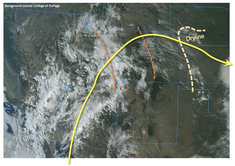
East of the Contintental Divide, downsloping flow will generally suppress any rainfall, leading to hazy, warm weather this afternoon as smoke continues to advect eastward in the steering flow. However, along the KS and NE border, a strong dryline will develop this afternoon, providing a notable convergence boundary for strong-to-severe afternoon thunderstorms (if they can break the convective “cap”). The odds of storm formation is limited, but if they do form, large hail, damaging winds and an isolated tornado will all be possible. Brief heavy rainfall will also be possible, but steering winds should quickly take the storms out of Colorado, thus mitigating any flood threat.
So overall, we expect a gradual increase in rainfall coverage today, but flooding is NOT expected. Much more active weather is expected for tomorrow so stay tuned to tomorrow’s FTB.
Today’s Flood Threat Map
For more information on today’s flood threat, see the map below. If there is a threat, hover over the threat areas for more details, and click on burn areas to learn more about them. For Zone-Specific forecasts, scroll below the threat map.
Zone-Specific Forecasts:
Grand Valley, Southwest Slope, Northwest Slope, Central Mountains, Northern Mountains, Southeast Mountains, San Juan Mountains and San Luis Valley:
Mostly cloudy with isolated to scattered showers and weak thunderstorms developing later this morning, and persisting into the early overnight hours. Max 1-hour rainfall up to 0.4 inches so flooding is NOT expected today. A Red Flag Warning is in effect for parts of the region, primarily due to the threat of dry lightning today.
Primetime: 1PM through midnight
Northeast Plains, Southeast Plains:
Mostly sunny early then partly cloudy with isolated to widely scattered thunderstorms possible mainly along the KS/NE border. Max 1-hour rainfall up to 1.2 inches. Large hail, damaging winds and an isolated tornado will be possible with the strongest storm.
Primetime: 3PM through 10PM
Front Range, Urban Corridor, Raton Ridge and Palmer Ridge:
Partly cloudy and hazy with isolated to widely scattered showers or weak storms possible later this afternoon and into the evening hours. Max 1-hour rainfall up to 0.4. inches. Gusty winds will be possible due to the dry sub-cloud layer.
Primetime: 4PM through 10PM