Issue Date: Tuesday, June 22nd, 2021
Issue Time: 9:10AM MDT
— Flooding is NOT expected today
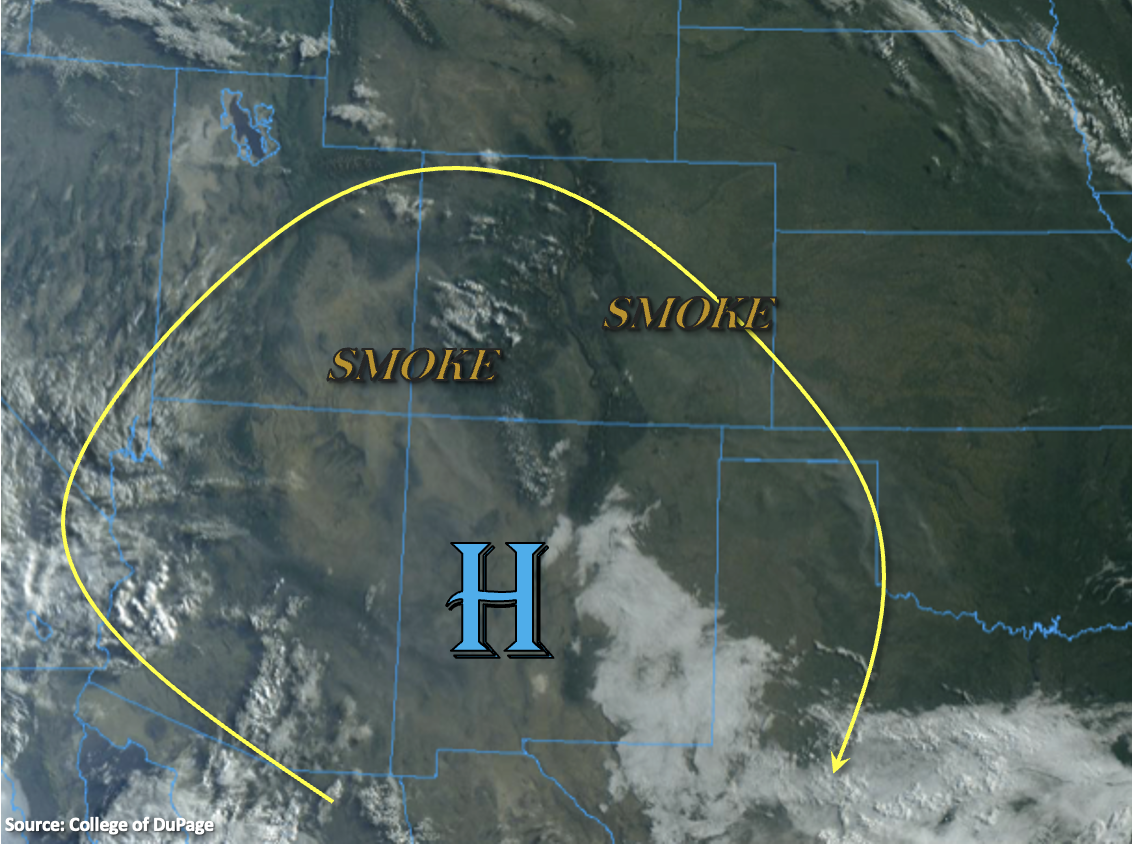
Not much change in the overall pattern today as the High continues to reinforce a dry air mass with west and northwesterly flow aloft. The ridge will begin to slide in from the west, so hot afternoon temperatures will return. There’s also a fair amount of smoke across the state from the ongoing wildfires in the area. Western Colorado has a little bit of moisture around 500mb that is helping produce the clouds over the western mountains in the visible satellite imagery below. While Grand Junction’s morning sounding measured near average PW at 0.62 inches, the moisture’s location in the mid-level of the atmosphere will make it difficult for any rainfall to reach the surface. Thus, the shortwave energy moving overhead this afternoon should only produce an increase cloud cover over northwestern Colorado. A Red Flag Warning has been issued for all areas west of the Continental Divide from noon to 9PM today.
Back over eastern Colorado, PW at Denver has dropped 0.32 inches over the last 24-hours to 0.42 inches. So, it’s quite dry, which will reduce the rainfall chances this afternoon to near zero. A couple high-based showers are possible south (mainly Southeast Mountains/Raton Ridge), but only light rainfall accumulations with possible strong outflow winds are forecast. Therefore, flooding is NOT forecast today.
Today’s Flood Threat Map
For more information on today’s flood threat, see the map below. If there is a threat, hover over the threat areas for more details, and click on burn areas to learn more about them. For Zone-Specific forecasts, scroll below the threat map.

Zone-Specific Forecasts:
San Juan Mountains, Central Mountains, Northern Mountains, Grand Valley, Southwest Slope & Northwest Slope:
It’s going to be hot this afternoon with highs reaching the upper 90Fs across the lower elevations and upper 80Fs over the mountain valleys. The moisture’s location in the mid-level of the atmosphere translate to an increase in cloud cover without measurable rainfall this afternoon. Flooding is NOT expected. A Red Flag Warning has been issued for all regions, so be cautious with any activities that could cause a spark. Near surface smoke should mix out over the Southwest Slope, but it will likely increase over the southern mountains and Northwest Slope this afternoon and evening.
Southeast Mountains, Front Range, Palmer Ridge, Raton Ridge, Urban Corridor, San Luis Valley, Northeast Plains & Southeast Plains:
A couple high-based, storms could form over the southern Front Range, Southeast Mountains, adjacent plains (south) and elevated ridges late this afternoon and early evening. Light rainfall accumulations up to 0.10 inches will be possible along with plenty of virga. The main threat will be lightning and outflow winds from the stronger storms that can develop (south). Highs will rebound into the 90Fs across the lower elevations with 80Fs for the mountain valleys, so I hope you enjoyed that brief cool down for the summer solstice. Flooding is NOT forecast.
Primetime: 3PM to 9:30PM