Issue Date: Tuesday, June 22, 2021
Issue Time: 9:30 AM MDT
Summary:
Monday was very calm in terms of precipitation. An early morning line of storms was present east of Limon along the I-70 corridor, before moving south and dissipating through morning, as mentioned in the FTB yesterday. Other than that, conditions remained dry across the state for the rest of the day. No flooding was reported on Monday. For rainfall estimates in your area, including antecedent conditions, check out the State Precipitation Map at the bottom of today’s post.
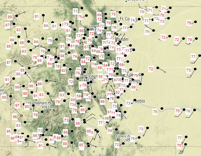
While astronomical summer technically started on Sunday, Monday felt much more like spring for some of the state. Cooler temperatures were left behind after the two cold frontal passages, with highs in the 60s for the high elevations and 70s for the Urban Corridor and Eastern Plains. The western half of the state wasn’t able to cool as much, and observed highs were in the 80s in the Northwest Slope and Grand Valley and well into the 90s in the Southwest Slope. Daily high temperatures across the state yesterday can be seen in the map below, with data populated from NWS and RAWS stations.
Click Here For Map Overview

