Issue Date: Monday, June 21st, 2021
Issue Time: 8:45AM MDT
— Flooding is NOT expected today
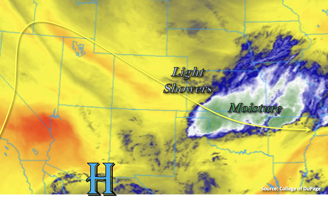
Eastern and northern Colorado are enjoying a cooler start to the morning behind the second reinforcing cold front that passed through the state. Pockets along the I-25 Urban Corridor are as much as 8 to 12F cooler than this time yesterday. Enjoy it while it lasts because hot temperatures are returning in a couple days! There is a tail of moisture from the disturbance yesterday that is combining with the jet to produce a line of light showers this morning over the eastern plains (Limon to Cheyenne Wells). Additional weak showers are present over the Southeast Mountains. These ongoing showers will likely continue through midday, but are expected to weaken throughout the morning and produce only minimal accumulations.
The center of the High continues to sit south and west of the state, which is producing northwesterly flow aloft. The main difference in today’s weather is that there are no disturbances forecast to move through the flow. The warmer and drier northwesterly flow will also help to stabilize and reduce the chances of precipitation this afternoon by creating an inversion aloft. A couple isolated, weak showers may be possible over the eastern mountains (southern border), if they can overcome the cap. Other than that, rainfall is not forecast over eastern Colorado this afternoon and evening.
Back to the west, it will be cooler north and hot again south as the front stalls out near the Grand Valley. Windy, dry and hot conditions are forecast again over the Grand Valley and Southwest Slope, so a Red Flag Warning has been re-issued. Rainfall is not forecast today, but some cloud cover over the mountains (south) may help a little with the heat this afternoon. Flooding is NOT forecast.
Today’s Flood Threat Map
For more information on today’s flood threat, see the map below. If there is a threat, hover over the threat areas for more details, and click on burn areas to learn more about them. For Zone-Specific forecasts, scroll below the threat map.

Zone-Specific Forecasts:
Southeast Mountains, Front Range, Urban Corridor, Palmer Ridge Northeast Plains, Southeast Plains & Raton Ridge:
There’s a light line of showers over the eastern plains this morning that will continue through about noon. Elsewhere, the inversion aloft should keep precipitation chances near zero. A couple weak storms may form over the Southeast Mountains (southern border) this afternoon, but flooding is NOT forecast. Cooler temperatures are also forecast today with highs in the 70Fs for the lower elevations and upper 60Fs for the elevated ridges and mountain valleys.
Primetime: Ongoing to Noon
Grand Valley, Southwest Slope, San Luis Valley, Northwest Slope, San Juan Mountains, Central Mountains & Northern Mountains:
Rainfall is not forecast this afternoon, but cooler temperatures in the 80Fs are forecast north of the cold front (Northwest Slope/Northern Mountains). It will remain dry, windy and hot further south and a Red Flag Warning has been issued for the Grand Valley and Southwest Slope. Near surface smoke should be reduce throughout the day, but it will likely increase this afternoon over the Northwest Slope. Flooding is NOT forecast.