Issue Date: Monday, June 14th, 2021
Issue Time: 2PM MDT
Valid Dates: 6/15 – 6/29
The main story this week will be the continuation of the early season heat wave as the ridge begins to strengthen over the next couple of days. Record heat was logged across many of the lower elevation areas out west on Sunday. More records may even be broken again with the 594mb line moving northwards over the next couple of days. The 102F recorded at the Grand Junction WFO yesterday moved into the top 10 hottest 1-day maximum temperature (rank: 8). We’ll be keeping an eye on record heat streaks for that area the next couple of days, too. Generally speaking, there’s a good chance that many locations across all of Colorado, below 5,500 feet, will cross the century mark (100F). We’re still not quite as hot as June 2012 (statewide), which is our warmest on record.
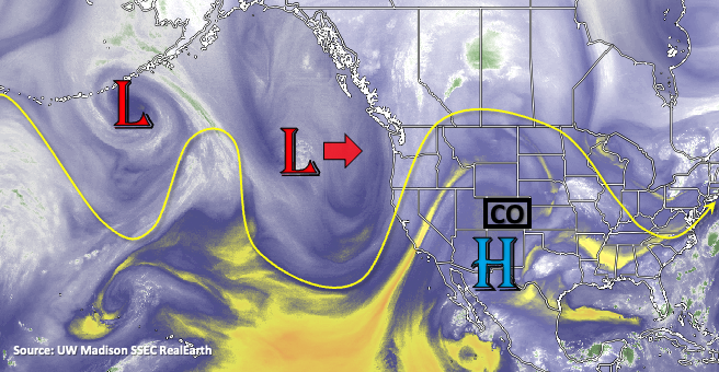
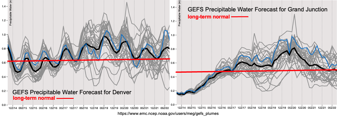
It will remain nearly dry over the next couple of days. This lull in precipitation during mid to late June is fairly typical before we transition over to the monsoon pattern. Residual moisture under the ridge may spark some weak afternoon convection over and near the mountains, but not much rainfall is anticipated. The ridge becomes flattened heading into next weekend by the approaching Low. The GEFS is hinting at higher moisture behind a weak cold front on Friday, while the EPS indicates less. Both imply enough moisture to return PM storm chances to the mountains (south and east). At this time there is No Apparent flood threat. The better chance for more severe storms and storm spill over into the eastern plains will likely be on Friday with the extra dynamics in place.
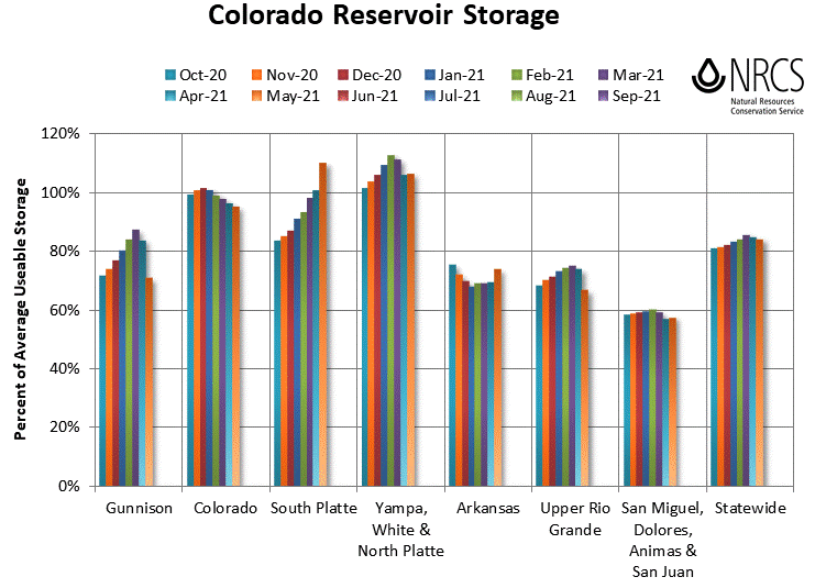
Taking a look at the May Colorado reservoir storage below, there’s nothing too surprising. As anticipated with the high snowpack, the South Platte storage is up to over 100%. The Arkansas storage also increased some when compared to April. This is a very typical pattern with snow melt increasing at this time of year. The largest deficient from April looks to be over the Gunnison basin where storage is about 70% of normal. Statewide, Colorado is slightly above 80% of average, which is lower than this time last year. With the much drier weather during June, especially out west, it will be interesting to see the storage reservoirs at the beginning of July.
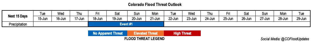
Event #1: Friday – Monday (6/18 – 6/21)
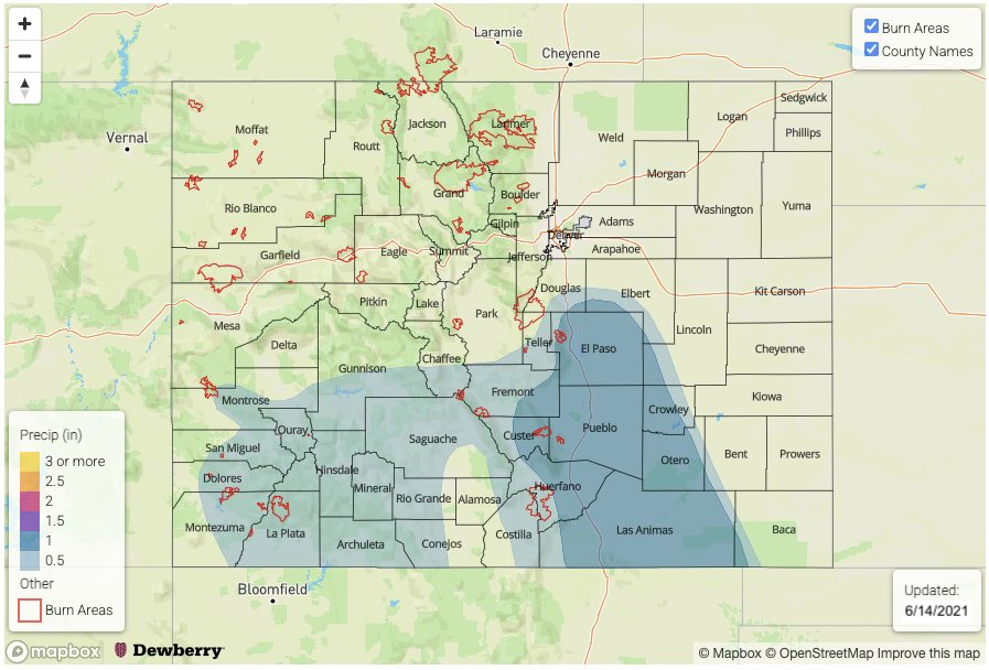
No Apparent flood threat as upslope driven storms return behind a cold front.
The biggest question about the next system will be how large the moisture return is behind the very welcomed cold front. Predicting moisture plumes this far out is a bit tough. Nonetheless, rainfall chances increase across the southern terrains, favoring the eastern mountains heading into this next weekend. It does look like storms will return to the San Juan Mountains as well with measurable rainfall likely both Friday and Sunday. Spill over storms into the adjacent eastern plains (south) is most likely on Friday and Saturday with a higher potential severe threat on Friday. So, Friday is the anticipated peak in activity, but at this time, there is No Apparent flood threat.