Issue Date: Monday, June 14, 2021
Issue Time: 9:15 AM MDT
Summary:
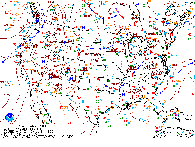
Thunderstorms began to fire up and down the Urban Corridor in the early evening yesterday thanks to a surface low located in the southeast corner of the state, and a persistent north-south trough. Both features can be seen in the WPC surface analysis valid for 6:00 pm yesterday (00Z) below.
A series of severe thunderstorm warnings were issued yesterday from the Colorado-Wyoming border to Colorado Springs associated with these storms, with the greatest threat being large hail. Clusters of damaging hail reports were made around Greeley, Southeast Denver, and Woodland Park areas, with the largest observation being 1.75 inch hail reported in Aurora. Heavy rain was not as large of a threat, however some isolated cells still saw rainfall rates of up to 1 inch/hour, according to the MetStorm Live grids in the State Precipitation Map.
Elsewhere, hot and dry conditions continued for the mountains and western slope, where fire danger remains critically high. Flooding was not reported on Sunday. For rainfall estimates in your area, check out the State Precipitation Map below.
Click Here For Map Overview
