Issue Date: Thursday, June 10, 2021
Issue Time: 9:15AM MDT
Summary:
There was little change in the large-scale weather pattern yesterday, resulting in another hot and dry day across Colorado. The ridge strengthening in the eastern half of the state limited storm development on the eastern plains, while southwesterly flow brought very dry air to the western half of the state. Flooding was not reported on Thursday. For rainfall estimates in your area, including antecedent conditions, check out the State Precipitation Map at the bottom of today’s post.
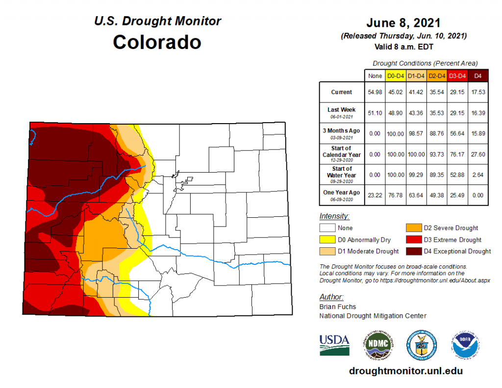
This week’s update of the U.S. Drought Monitor is below, which is valid through Tuesday morning. There is little change from last week, and the drastic difference between the eastern and western halves of the state is apparent. Still, there were some small improvements in drought conditions, particularly along the New Mexico Border. However, the area of D4 “exceptional drought” conditions on the Western Slope increased in area by about 1%.
The exceptional drought is taking its toll on water resources. The Yampa, Colorado, Gunnison, Uncompahgre, and Dolores rivers are among many on the western half the state with much below normal (<10th percentile) streamflow this time of year.
Click Here For Map Overview

