Issue Date: Wednesday, June 9, 2021
Issue Time: 9:15AM MDT
Summary:
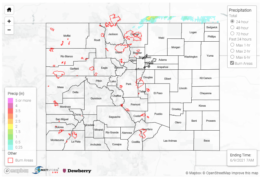
Yesterday was another hot and dry day across nearly the entire state, as high pressure in the southwest continued to stifle changes in the large-scale pattern. There were only a handful of isolated Trace to 0.20 inch precipitation observations scattered across the state by CoCoRaHS observers and other networks.
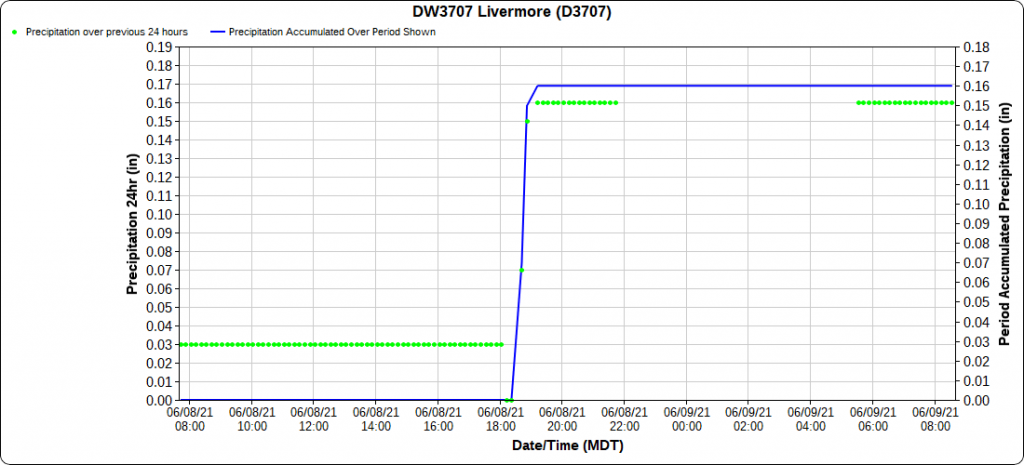
The 4:00 pm update to the Flood Threat Bulletin yesterday indicated a cumulus field over the northern Front Range, Medicine Bow, and Laramie Mountains. This eventually developed enough to drop a very quick 0.17 inches of rain at Livermore in northern Larimer County shortly after 6:00 pm, as seen in the time series plot below. However, the heaviest precipitation associated with these cells ended up falling north of the border in Wyoming.
No severe weather warnings were issued, and no flooding was reported yesterday. For rainfall estimates in your area, including antecedent rainfall conditions, check out the State Precipitation Map below.
Click Here For Map Overview
Note: The 24-hour, 48-hour and 72-hour total precipitation do not contain bias corrections today due to errors in the CoCoRaHS data. This means there may be underestimations in QPE over the southwest and southeast corners of the state.
