Issue Date: Monday, June 7th, 2021
Issue Time: 12:45PM MDT
Valid Dates: 6/8-6/22
The sudden transition to summer heat across Colorado will unfortunately not just be a temporary feature. As shown in the water vapor image, below, a large-scale trough will anchor itself off the North American west coast over at least the next 7 days, allowing for a reemergence of a very strong ridge centered over the Continental Divide. In turn, this will allow for a prolonged period of much above normal temperatures to the tune of 5-15F every day over the course of at least the next 7-10 days, and possibly even longer.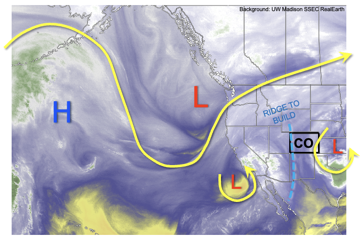
A cut-off low, currently off the southern California coast will merge back into the large-scale flow and quickly skirt across northwest Colorado over the next 72 hours. However, it’s primary impact will be to allow for the infiltration of very dry air into our state from the subtropical Pacific Ocean. This can be seen in the forecast PW plumes at Denver, and especially at Grand Junction where a prolonged stretch of significantly below normal PW is expected. It is likely that this will raise the threat of wildfires especially during days with gusty winds. Overall, we expect very little precipitation even across the climatologically favored higher terrain.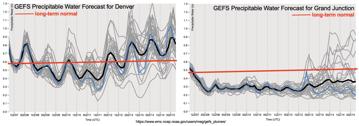
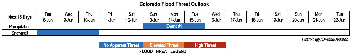
East of the Continental Divide, a cool front passage is expected on Friday, 6/12, after which some return moisture will likely find its way into Colorado from the south and east. This will allow for at least a temporary resurgence of marginal instability, which will support scattered shower and thunderstorm activity mainly over the higher terrain east of the Continental Divide. Some spill over into the eastern plains is possible, though that remains uncertain at this point. Overall, there’s enough consensus to identify a precipitation Event #1 for next weekend. However, at this time, less than 1.0 inch of precipitation is expected over the course of the event. Thus, there is No Apparent Flood Threat.
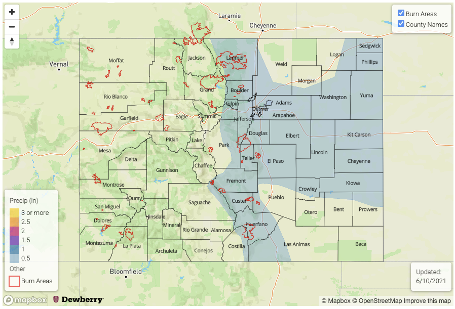
With the very hot weather expected this week, the last of higher elevation snow should melt over the next few days. A check of major river flows this afternoon does not show any flooding concerns as the snowmelt has been spread out over a long enough duration to prevent build up of melt water.
Below, we discuss the identified precipitation event in more detail.
Event #1: Sunday – Tuesday (June 13 – June 15)
Showers and storm coverage to increase mainly over higher terrain, but No Apparent Flood Threat at this time
Moisture will increase east of the Continental Divide with PW expected to be in the 0.7-1.1 inch range beginning Sunday. This will allow for the re-emergence of scattered showers and thunderstorms across climatologically favored higher terrain of the Front Range, Palmer Ridge, Southeast Mountains and Raton Ridge. With relatively week steering flow and sheer expected, most activity will be in the pulse variety type, with up to 0.5 inches of rainfall over a 30 minute period possible. Some organization of activity could occur given the presence of surface frontal features and dynamics aloft, which would allow for an eastward extension of storms off the higher terrain and into the Northeast and Southeast Plains. Overall though, only up to 1.0 inch of precipitation, locally, is expected at this point. Thus, flooding is NOT expected.