Issue Date: June 3rd, 2021
Issue Time: 11:30AM MDT
Valid Dates: 6/4-6/18
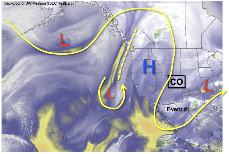
As discussed in the previous Outlook, after a generally cool and rain May, very significant changes are on the way for Colorado’s weather. As shown in the water vapor image, below, a very strong ridge has set up shop over the western United States. Thus far, it has stayed far enough west that Colorado’s temperatures have stayed close to seasonal normal. However, numerous daily and even monthly all-time heat records have been set in CA, NV, ID, OR and WA, an impressive feat given that it is still very early in the month and climatological averages rise sharply through the month of June.
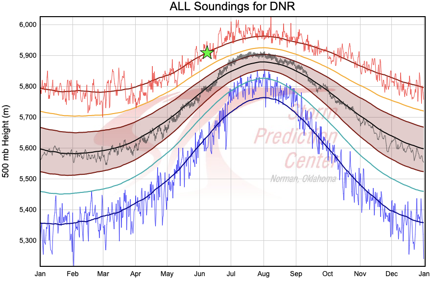
The aforementioned strong ridge will shift east-northeast over time and also expand rapidly eastward, which will cause much warmer weather across our entire state. The chart below shows the climatology of 500mb heights taken from Denver soundings dating back to the 1940s. The 500mb level is roughly 20,000ft above sea level (~15,000 feet above ground level in Denver or Grand Junction), and the exact height of this level correlates fairly strongly to the average temperature from the ground to that height. The green star in the chart below shows the forecast 500mb height over Colorado next week, which is expected to approach or exceed 5,900 meters (19,400 feet). This high of a value would place it near record territory for early June, which is why we expect much above normal temperatures to persist beginning tomorrow. High temperatures above 100F will be possible next week in lower elevations if current forecasts hold.
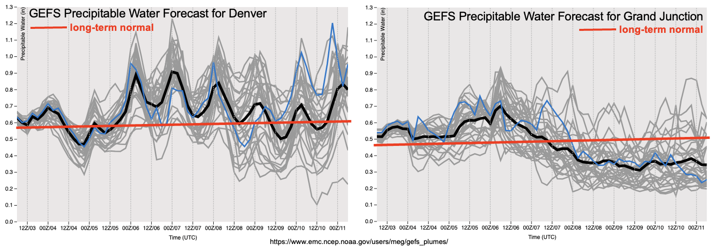
Although very hot temperatures are typically associated with dry weather in Colorado, a big caveat is that there is a significant pool of residual moisture in place over the southwest United States from the passage of the previous disturbance. In fact, this disturbance, Event #1, will actually “retrograde” slightly to the west and advect moisture into southern Colorado (see water vapor image above). As shown in the PW forecast plumes, below, both Denver and Grand Junction will experience above normal to significantly above normal moisture content over the next 72-96 hours. While the ridge will undoubtedly limit the efficiency of rainfall generation, we nonetheless expect daily rounds of mainly higher elevation showers and weak storms especially over the southern high terrain. However, only short-term light to moderate intensity rainfall is expected, thus there is No Apparent Flood Threat with Event #1. Longer-range guidance suggests the persistence of the strong ridge somewhere over the west-central United States, which would keep our temperatures significantly above normal for the duration of the next 7-14 days. Thus, no additional organized precipitation events are foreseen.
Lastly, with the much above normal temperatures, we expect the snow melt season to generally wind down by early next week. The South Platte River basin still has widespread high-elevation areas with 10+ inches of Snow Water Equivalent. With this expected to melt out to the tune of 2+ inches of SWE per day, smaller tributaries could certainly see some minor flooding along river banks. However, with the absence of meaningful precipitation, we do not foresee any major flooding concerns at this time.
Below, we discuss the identified precipitation event in more detail.
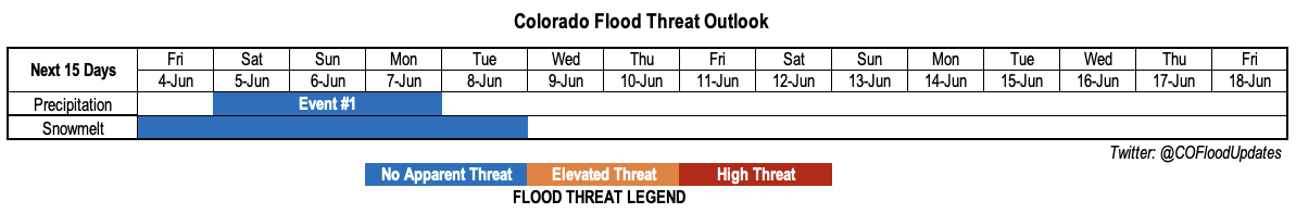
Event #1: Saturday-Monday (June 5 – June 7)
Daily pulses of light to moderate intensity showers and storms, but No Apparent Flood Threat
Scattered shower and weak thunderstorm activity will occur in daily afternoon and evening pulses, mainly limited to the higher terrain of the San Juans and Southeast Mountains with lower coverage and weaker intensity for the Central Mountains and Northern Mountains. Limited instability will be partially counteracted by weak steering flow to produce max 1-hour rainfall up to perhaps 0.50 inches locally. Over the 72-hour period, a few lucky locations could receive close to 1 inch, but the norm will be more in the 0.25-0.50 inch range.
At this time, it does not appear that lower elevations (on either side of the Continental Divide) will see much if any rainfall as warm mid-level temperature will inhibit convection.