Issue Date: Friday, May 28, 2021
Issue Time: 9:15 am MDT
Summary
High pressure in Western & Central Colorado yesterday dominated the weather pattern across the state, creating calm conditions. For rainfall estimates in your area, check out our State Precipitation Map at the bottom of today’s post.
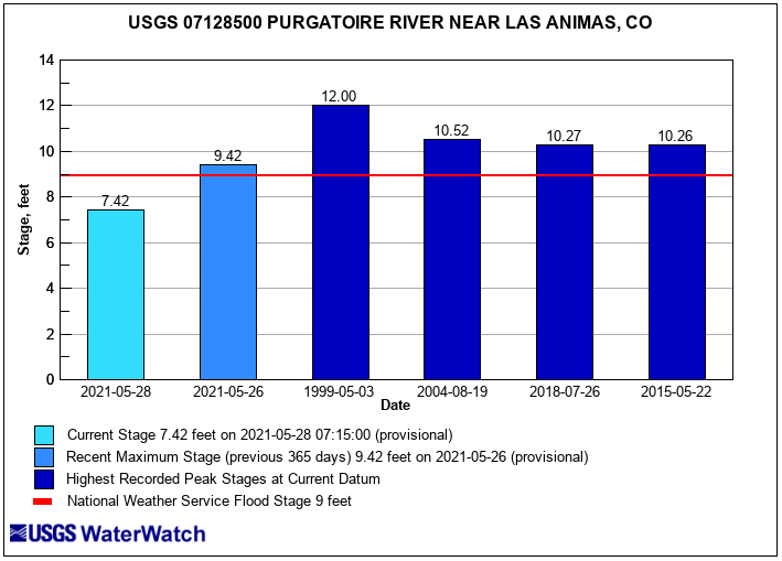
The flows on the Purgatoire River near Las Animas in Bent County are below minor flood stage. The graph below shows todays gauge height in feet at the Purgatoire River near Las Animas, next to the most recent flood stage report, and historical stages for context. The Purgatoire River and Cache la Poudre River are still experiencing higher than normal streamflow but are stable and below flood stage.

Click Here For Map Overview
Note: The 24-hour, 48-hour and 72-hour total precipitation do not contain bias corrections today due to errors in the CoCoRaHS data. This means there may be underestimations in QPE over the southwest and southeast corners of the state.
