Issue Date: Monday, May 24, 2021
Issue Time: 9:15 am MDT
Summary
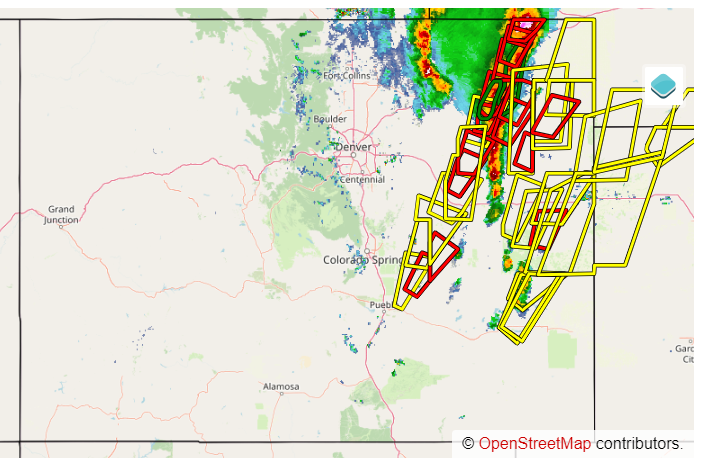
Sunday was another active severe weather day across the Eastern Plains as lines of storms fired up along a stationary front that extended north-south across the eastern half of the state. Heavy rain, large hail, high winds, and several tornadoes were reported yesterday afternoon. The progression northward of the strongest storms can be seen in the map of issued severe thunderstorm and tornado warnings, with underlying radar at 4:35 pm. A line of storms is seen on the radar, including a large tornado right near the CO-NE border.
As the system passed, flood advisories were issued due to Doppler radar indicated heavy rain and the potential for small stream flooding under areas that received a very quick 1-2 inches of precipitation. According to the MetStorm Live grids in the State Precipitation Map below, 1-hour rainfall rates were up to 1.5 inches/hour for some of these locations.
Despite the active day, flooding was not reported on Sunday. For rainfall estimates in your area, check out our State Precipitation Map below.
Click Here For Map Overview
Note: The 24-hour, 48-hour and 72-hour total precipitation do not contain bias corrections today due to errors in the CoCoRaHS data. This means there may be underestimations in QPE over the southwest and southeast corners of the state.

