Issue Date: Friday, May 21, 2021
Issue Time: 9:30 am MDT
Summary
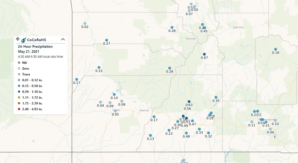
The southwest corner of the state received moderate rain and even snow overnight into the early hours this morning. One CoCoRaHS observer in Silverton remarked that it was “hard to believe so much water but that’s what was in the can” after 0.67 inches of rain and snow fell at their station. Durango also received 0.20-0.60 inches of precipitation across the city and its surroundings. This region of the state has been in extreme to exceptional drought for a while, so rain and snow is welcome news. Due to the timing of the overnight precipitation, these precipitation totals may not be reflected in the State Precipitation Map yet, but can be seen in CoCoRaHS map for precipitation observations ending between 4:30-9:30 am today.
There were also severe thunderstorms in the northeastern corner of the state yesterday, with a couple warnings issued by the NWS. One cell west of Sterling produced up to 3.25 inch hail stones and a tornado even touched down briefly in an open field according to trained spotters.
Flooding was not reported on Thursday. For rainfall estimates in your area, check out our State Precipitation Map below.
Click Here For Map Overview
The map below shows radar-estimated, rainfall gage-adjusted Quantitative Precipitation Estimates (QPE) across Colorado. The map is updated daily during the operational season (May 1 – Sep 30) by 11AM. The following six layers are currently available: 24-hour, 48-hour and 72-hour total precipitation, as well as maximum 1-hour, 2-hour and 6-hour precipitation over the past 24 hour period (to estimate where flash flooding may have occurred). The accumulation ending time is 7AM of the date shown in the bottom right corner. Also shown optionally are vulnerable fire burn areas (post 2012), which are updated throughout the season to include new, vulnerable burn areas. The home button in the top left corner resets the map to the original zoom.

