Issue Date: Thursday, May 20th, 2021
Issue Time: 8:50AM MDT
— Flooding is NOT expected today
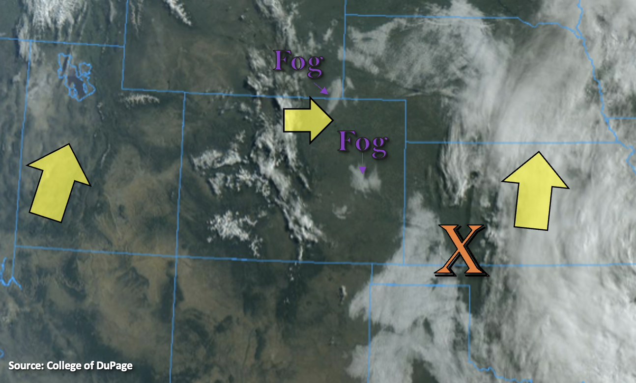
The drying trend continues across the state, which can be seen by the clear skies this morning. Outside of some fair weather cumulus over the mountains and spotty fog over the adjacent plains, it’s a warm and sunny start to the day. Today, CO will become sandwiched between a departing system (orange “X”) and incoming system from the west. Weak westerly flow will begin to turn more southwesterly throughout today and diffluence flow aloft will develop. This flow is forecast to send a weak shortwave across the state, which will mix with some residual moisture over the northeast corner of the state and eastern plains (associated with the departing disturbance). Scattered storms look to favor the Front Range and Palmer/Raton Ridges for develop by early afternoon. With low level moisture decreasing at the surface over the adjacent plains, storms are forecast be high-based and produce some brief outflow winds with only light rainfall. As storms move into the eastern plains, a couple low-end severe storms are possible along a dryline that sets up. The main threats from the severe storms would be hail, wind and brief heavy rainfall. Flooding is NOT forecast today.
Back over western Colorado, large dew point depressions mean the main threat from the isolated mountain storms today will be strong winds with plenty of virga. However, early tomorrow morning, the jet starts to poke into the southwest corner of the state from the approaching system, and this will draw some moisture northward from the Pacific/Gulf of California. These two features are forecast to produce some early morning showers over the San Juan and Central Mountains, which are expected to continue and expand in coverage tomorrow. Finally, some measurable rainfall in the forecast.
Today’s Flood Threat Map
For more information on today’s flood threat, see the map below. If there is a threat, hover over the threat areas for more details, and click on burn areas to learn more about them. For Zone-Specific forecasts, scroll below the threat map.
Zone-Specific Forecasts:
Raton Ridge, Palmer Ridge, Front Range, Southeast Mountains, Southeast Plains, Northeast Plains & Urban Corridor:
Warm day ahead with highs in the 80Fs across the lower elevations and mid-60Fs in the mountain valleys. Storms will favor development over the Front Range and adjacent ridges this afternoon where there is some residual moisture to work with. High-based showers mean only light rainfall is forecast over the mountains and adjacent plains with 1-hour rain rates up to 0.25 inches possible. As the storms move into the adjacent plains along and near the dryline, slightly heavier rainfall is forecast – if they can break the cap. Max 1-hour rain rates up to 1 inch (north) and 0.75 inches (south) will be possible. Flooding is NOT forecast.
Primetime: 1PM to 8PM
San Juan Mountains, Central Mountains, Northern Mountains, Northwest Slope, Grand Valley, Southwest Slope & San Luis Valley:
Warm day ahead with plenty of sunshine and afternoon cloud cover over the mountains. Highs over the lower elevations will reach from the mid 70Fs to mid 80Fs with 70Fs for the higher elevation valleys. Outside of some sprinkles, rainfall is not forecast this afternoon. Additionally, it’s going to get windy with a tightening surface gradient. Red Flag Warnings and Wind Advisories have been issued. Showers are forecast begin late tonight/early tomorrow morning over the San Juan and Central Mountains. Rain rates will generally be between 0.05 and 0.10 inches per hour.
Primetime: 2AM to ongoing