Issue Date: Friday, May 14, 2021
Issue Time: 9:00 am MDT
Summary
May 13 was another calm and clear day across the state, as a weak high-pressure ridge in the southwest corner of the state dominated the weather pattern. As such, there was only trace to very light (0.1-0.2”) precipitation recorded at the various CoCoRaHS, SNOTEL, and MesoWest gauges scattered across the state. Flooding was not reported on Thursday. For rainfall estimates in your area, check out our State Precipitation Map below.
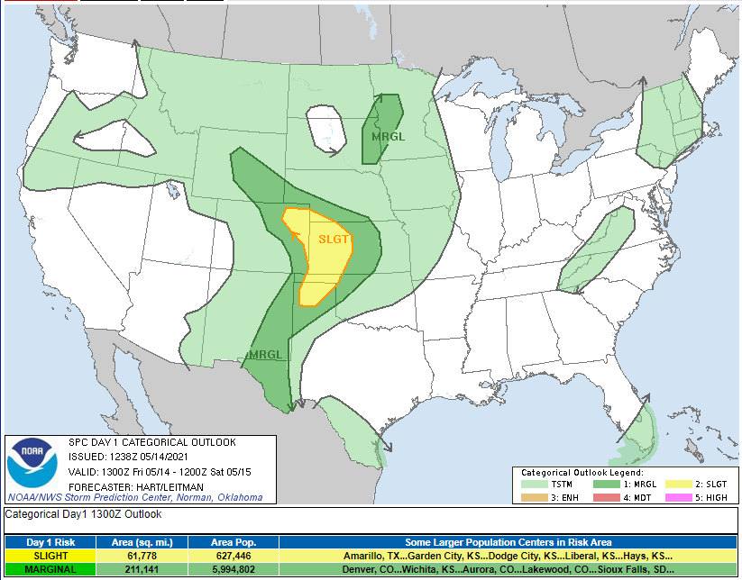
There was potential for isolated but severe thunderstorms on the Northeastern plains yesterday, and while nothing serious materialized in Colorado, just across the border in Kansas, a landspout tornado was reported along I-70. Nearly all of the state has the potential for thunderstorms today according the SPC map below. The area of marginal risk for convective activity today includes Denver and the northern Front Range, and slight (higher than marginal) risk is extended to the Northeast Plains.
Click Here For Map Overview
The map below shows radar-estimated, rainfall gage-adjusted Quantitative Precipitation Estimates (QPE) across Colorado. The map is updated daily during the operational season (May 1 – Sep 30) by 11AM. The following six layers are currently available: 24-hour, 48-hour and 72-hour total precipitation, as well as maximum 1-hour, 2-hour and 6-hour precipitation over the past 24 hour period (to estimate where flash flooding may have occurred). The accumulation ending time is 7AM of the date shown in the bottom right corner. Also shown optionally are vulnerable fire burn areas (post 2012), which are updated throughout the season to include new, vulnerable burn areas. The home button in the top left corner resets the map to the original zoom.

