Issue Date: Thursday, May 13, 2021
Issue Time: 9:15 am MDT
Summary
Yesterday was fairly uneventful in terms of precipitation across the state. A line of thunderstorms extending into the Northeast Plains from the Nebraska border dropped a quick 0.1-0.4 inches of rain yesterday afternoon. Additionally, a handful of high-elevation SNOTEL stations had light accumulations too. Flooding was not reported on Wednesday. For rainfall estimates in your area, check out our State Precipitation Map below.
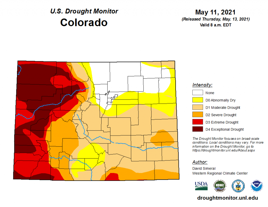
Updates to the U.S. Drought Monitor were published today, with great news for Northeast Colorado as the area of “None” drought conditions expanded following the latest soaking rain at the start of the week. On the flip side, the southern and western halves of the state are still experiencing moderate to exceptional drought, with the worst of it following along the Northwest and Southwest Slopes, as well as into the Grand Valley. Unfortunately, there doesn’t look to be much help coming in the forecast either aside from isolated thunderstorms, which have the potential to be more harmful than helpful as gusty outflow winds can contribute to elevated fire danger.
Click Here For Map Overview
The map below shows radar-estimated, rainfall gage-adjusted Quantitative Precipitation Estimates (QPE) across Colorado. The map is updated daily during the operational season (May 1 – Sep 30) by 11AM. The following six layers are currently available: 24-hour, 48-hour and 72-hour total precipitation, as well as maximum 1-hour, 2-hour and 6-hour precipitation over the past 24 hour period (to estimate where flash flooding may have occurred). The accumulation ending time is 7AM of the date shown in the bottom right corner. Also shown optionally are vulnerable fire burn areas (post 2012), which are updated throughout the season to include new, vulnerable burn areas. The home button in the top left corner resets the map to the original zoom.
