Issue Date: Wednesday, May 12, 2021
Issue Time: 9:40 am MDT
Summary
Yesterday saw diminishing precipitation associated with the low-pressure system that brought heavy mountain snow and widespread precipitation across the eastern half of the state. Still, mountain SNOTEL stations picked up an additional 3-7 inches of snow in 24-hours, bringing some total snow depths with this storm to over 14 inches in Boulder and Larimer Counties. Accumulated liquid precipitation for the past few days shows the Front Range and Eastern Plains picked up significant amounts of moisture – up to 2.25 inches. Flooding was not reported on Monday. For rainfall estimates in your area, check out our State Precipitation Map below.
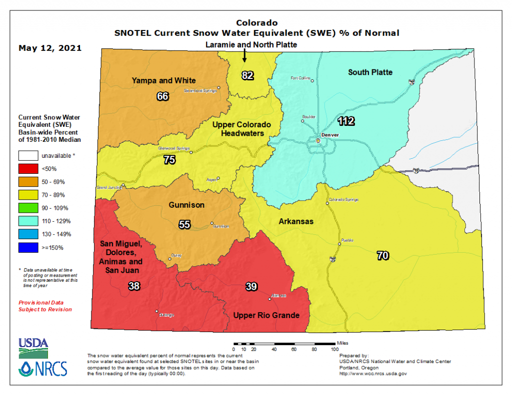
This added moisture helped boost the South Platte Basin’s current snowpack (as snow water equivalent) to 112% of normal! Unfortunately, the good news does not extend to the rest of the state, with remaining basins well below normal snowpack. The San Miguel-Dolores-Animas-San Juan and Upper Rio Grande Basins saw almost no accumulated precipitation associated with this spring storm, and are now below 50% of normal snowpack, according the NRCS map below.
Click Here For Map Overview
The map below shows radar-estimated, rainfall gage-adjusted Quantitative Precipitation Estimates (QPE) across Colorado. The map is updated daily during the operational season (May 1 – Sep 30) by 11AM. The following six layers are currently available: 24-hour, 48-hour and 72-hour total precipitation, as well as maximum 1-hour, 2-hour and 6-hour precipitation over the past 24 hour period (to estimate where flash flooding may have occurred). The accumulation ending time is 7AM of the date shown in the bottom right corner. Also shown optionally are vulnerable fire burn areas (post 2012), which are updated throughout the season to include new, vulnerable burn areas. The home button in the top left corner resets the map to the original zoom.
