Issue Date: Tuesday, May 11th, 2021
Issue Time: 9:40AM MDT
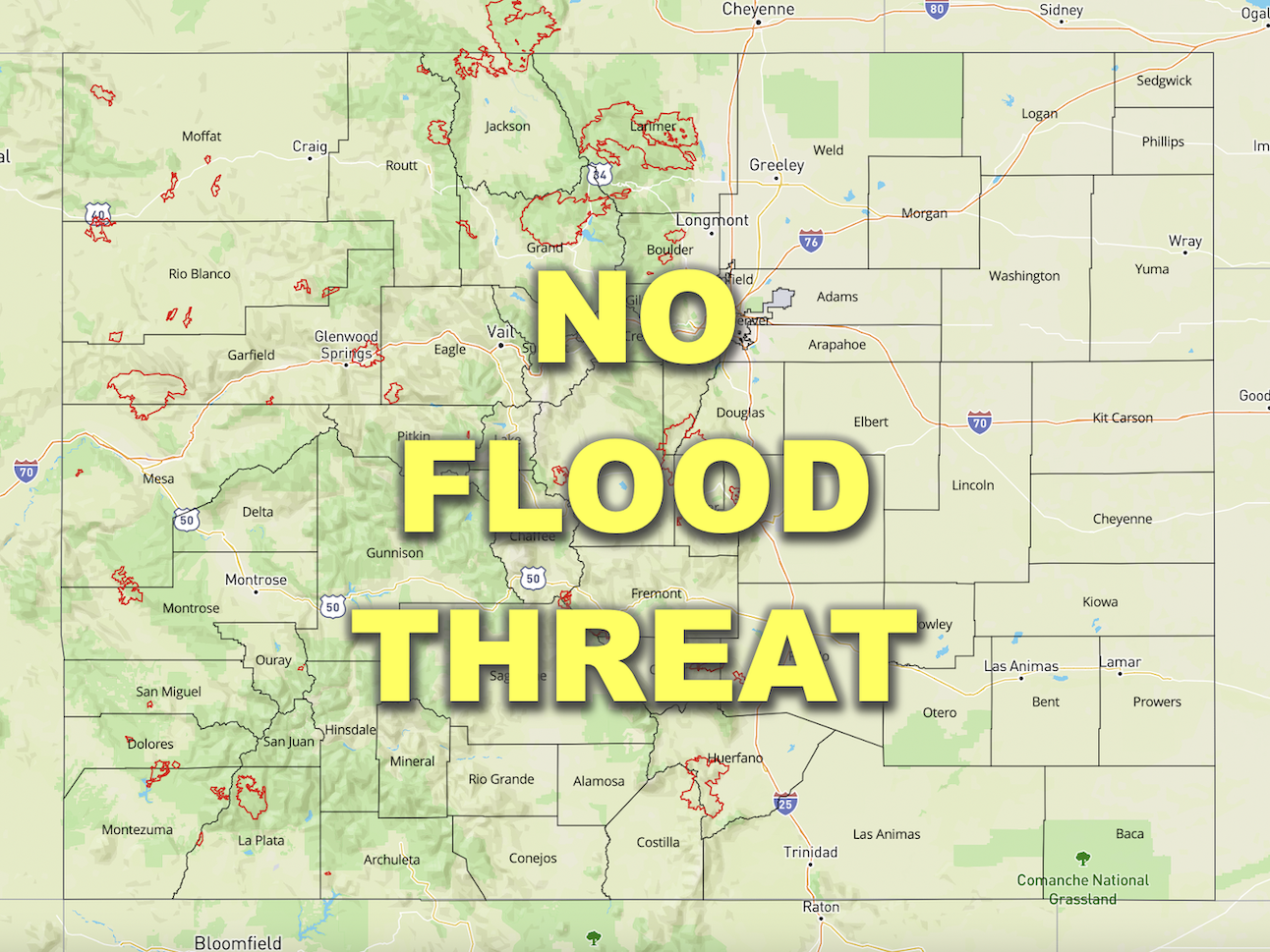
— Flooding is NOT expected today
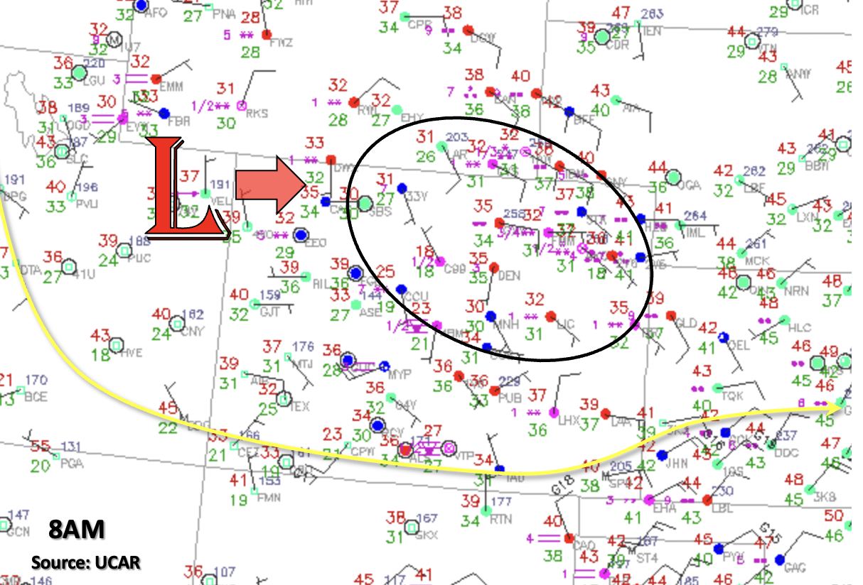
It’s a cold and wet start to the morning across the state. Temperatures below (red numbers) show freezing conditions for the majority of the state with the exception of the lowest elevations (eastern plains and western slope). Currently, fog is present over the mountain valleys, along with a rain/snow mix for the eastern plains and patchy, moderate snowfall over the Northern Mountains. The upper Low will traverse eastward across the northern portion of the state today, which will produce upslope flow over the region outlined in black below. So, although there is a slight break in precipitation now, it is forecast to pick back up early this afternoon.

Soundings this morning show that drier air has worked its way into the atmosphere above 600mb both east and west of the Continental Divide. Thus, PW values have dropped off about a tenth of an inch from yesterday and were measured around 0.40 inches. With the Low overhead helping to provide lift and plenty of moisture, an increase in precipitation is forecast over the Northern Mountains, Front Range, Urban Corridor and Palmer Ridge early this afternoon. Over the highest elevations, this will be in the form of snow, over the plains rainfall is most likely, and over the foothills and elevated Palmer Ridge mixed precipitation will likely occur. Once again, limited instability and lower PW values mean more stratiform precipitation with perhaps only a little embedded convection. With precipitation rates well below flooding thresholds and more snow for the mountains, flooding is not forecast. Precipitation should start to come to an end this evening, first east then west.
Today’s Flood Threat Map
For more information on today’s flood threat, see the map below. If there is a threat, hover over the threat areas for more details, and click on burn areas to learn more about them. For Zone-Specific forecasts, scroll below the threat map.
Zone-Specific Forecasts:
Northwest Slope, Northern Mountains, Central Mountains, Front Range, Urban Corridor, Northeast Plains & Palmer Ridge:
Another 6-8 inches could fall this afternoon over the Front Range and Northern Mountains above 8K feet making for messy traveling conditions. The Winter Storm Warning issued by the NWS remains in effect until 6PM. Over the Northern Mountains and Southwest Slope, totals up to 0.75 inches and 0.50 inches will be possible, respectively. Over the Urban Corridor and western Palmer Ridge, totals up to 0.75 inches will be possible by morning with a rain/snow mix over the Palmer Ridge. Ongoing rainfall should become more discrete over the Northeast Plains by this afternoon/evening, and isolated totals just under 0.50 inches are possible. Precipitation will end from east to west starting early this evening.
It is likely that with precipitation over the last couple of days, the Calwood burn area soils are saturated. With a rising freezing line throughout the day, precipitation this afternoon may fall as rainfall over the burn area. Although hourly rain rates are below flood threat criteria today, 24-hour totals could add another 0.25 inches to the area making soils unstable. Thus, a Low flood threat will be issued for extra caution.
Primetime: Ongoing to 10PM
Grand Valley, San Juan Mountains, Southwest Slope, San Luis Valley, Southeast Plains, Southeast Mountains & Raton Ridge:
Current rainfall over the Southeast Plains should start to come to an end by about noon as favorable lift and moisture moves away from the area. Some weak showers may be possible these evening as the Low moves east over the area. Overall, it is looking to be dry and cool for the mountains, Raton Ridge and Southeast Plains. Back to the west, temperatures will reach into the mid-60Fs over the Grand Valley, Southeast Slopes and San Luis Valley with plenty of sunshine to go around.