Issue Date: Monday, May, 10th, 2021
Issue Time: 2:45PM MDT
Valid Dates: 5/11 – 5/25
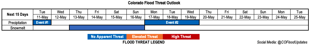
The Low that has been influencing Colorado’s weather the last couple days will continue to do so for one more day on Tuesday (Event #1). This system is expected to track through the state tomorrow, which will continue snow at the higher elevations early on Tuesday and help produce rain over the eastern plains. Behind this system, a weak but broad area of High pressure is forecast to fill in over the state, which will help dry things out and warm up temperatures by the week’s end. Outside of some weak scattered thunderstorms over the weekend, it should be fairly dry. By early next week, it looks like some energy pinches off from the trough currently over the Pacific, which will bring another couple days of cooler temperatures and rainfall to Colorado (Event #2).
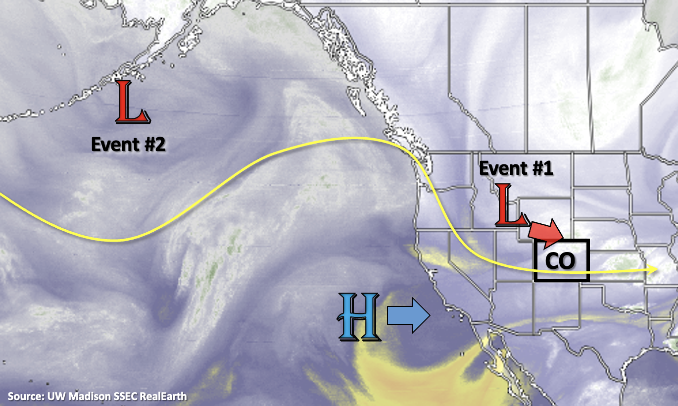
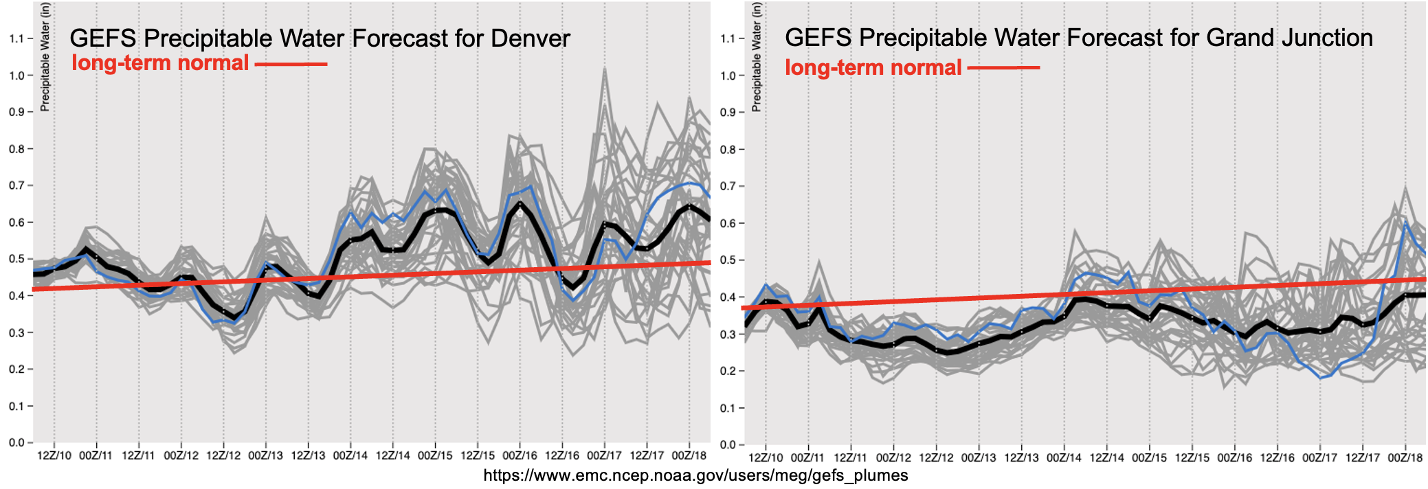
PW values will start to drop off to average or slightly below average from west to east beginning overnight. This paired with more stratiform precipitation tomorrow means that there is No Apparent flood threat issued. As a broad ridge builds in from the west, a drier airmass fills in which will reduce the precipitation chances by the end of this week and over the weekend. Quite a few differences in the evolution and location of the cutoff Low for Event #2, but it looks like PW and rainfall chances will be on the rise as the system moves into the Desert Southwest early next week. Expecting a slight cool-off with the system and precipitation accumulation to be mostly east of the Continental Divide.
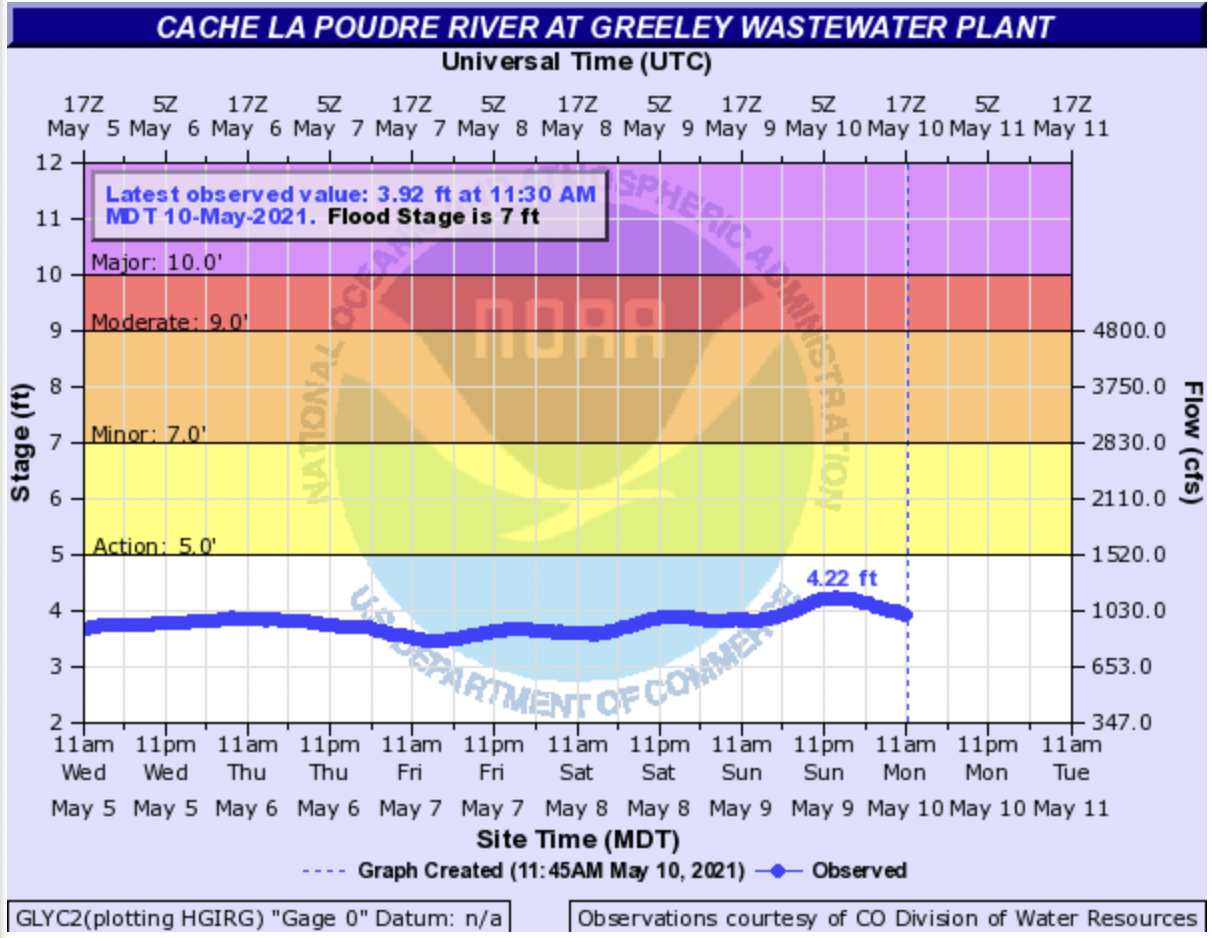
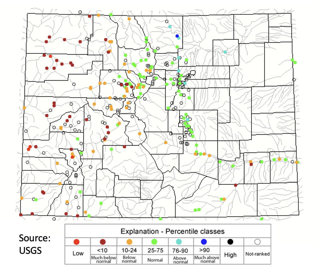
Recent posts have been talking about the above average snowpack for the South Platte River Basin and the concern for high flows along the Cache La Poudre River. That region has received more precipitation over the last 48-hours (plus today). By Friday afternoon, temperatures are forecast to rebound to 5 to 10 degF above average. So, the slightly elevated flow (shown below) paired with increasing temperatures by this weekend could mean that the streamflow gage near Greeley may come close to or reach into the Action stage. Minor flooding is not anticipated at this time, so there is No Apparent flood threat for runoff. Other gages in the area are running in the 76th to 90th percentile with the majority of the gages along the front range and eastern plains in the 25th to 75th percentile. These early season cold snaps wedged between longer warm periods really help to temper the runoff.
Event #1: Tuesday (5/11)
No Apparent flood threat as stratiform rainfall tapers off from west to east over the next 24-hours.
Rainfall should be mostly confined to the eastern plains by tomorrow afternoon. However, some snow will be possible over the Northern Mountains and Front Range as the Low moves overhead. Additionally, in the morning, snowfall could impact the commute along the I-25 corridor due to the snowline dropping overnight. By early evening, instability should drop off along with upper dynamics, so precipitation is forecast to taper off. Totals around 0.50 inches will be possible over the Northeast Plains, indicating that there is No Apparent flood threat.
Event #2: Monday – Wednesday (5/17 – 5/19)
No Apparent flood threat as the next cutoff Low moves into the Desert Southwest.
Still quite a bit of differences between models and runs for Event #2, but it looks like the next system will move in at the start of next week. As far as totals, going with the slightly drier solution produced by the European model. Overall, it looks like a slight cool-down to start the week, but not quite as cool as these last two systems. Rainfall will general be focused over the mountains and east of the Continental Divide. Heavier rainfall looks be located over the eastern plains and some stronger thunderstorms are possible if a shortwave passes at peak heating. It’s a bit too far out to nail down these details, so be sure to tune back into the FTO on Thursday for the latest. Summer-like temperatures and dry conditions are forecast over western Colorado.