Issue Date: 7/23/2015
Issue Time: 2:30PM
Dates covered: 7/24 – 8/7

As July transitions into August, the Southwest U.S. monsoon typically strengthens, providing increased rainfall chances to mainly central and southern Colorado. In particular, the regions seeing the highest average August rainfall are the Palmer Divide southward through the Sangre de Cristos as well as the San Juan Mountains. For this Flood Threat Outlook, covering July 24th through August 7th, it is precisely these areas that stand to receive the most rainfall across the state. However, it will not only be monsoon surges that support the rainfall chances. In fact, a relatively active storm track will send several Pacific cool fronts across the Rockies and into Colorado. And in between events, there will be several hot and dry days as the subtropical high pushes in from the south and southeast directions. A good example of this is today (Thursday 7/23), as seen by the water vapor image below. Despite waviness in the jet stream, dry air is being funneled from the southwest as two high pressures are in seen to be in control.
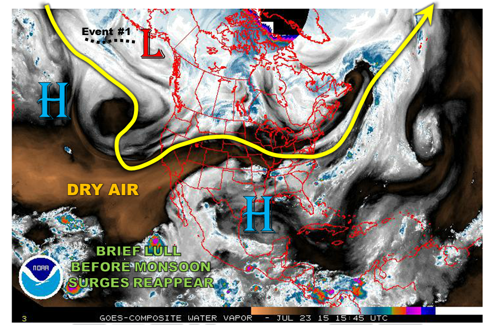 During the 15 day period covered by this Flood Threat Outlook, we see two precipitation events. The origin of the first is seen on the water vapor image above. It is a disturbance associated with a low pressure system over the Bering Sea. Meanwhile, the second event is not visible on the image above but is expected to develop as a consolidation of Central Pacific disturbances and tropical moisture reach Colorado. Now, on to the specifics:
Event #1: Monday (7/27) through Tuesday (7/28)
An Elevated Flood Threat as a cool front slowly pushes southward across Colorado
Starting Monday 7/27, a cool front and attendant low pressure system are expected to drop southeastward from the Canadian Rockies. This will temporarily shift low-level flow to the east and provide a good chance for heavy rainfall. It appears that the best threat will be east of the Divide, where up to 1.5 inches may fall. At this time, it also appears that most of the action will be on Monday. However, it is possible that the front is still draped across southeast Colorado on Tuesday, hence, a continuation of the threat until then.

Event #2: Saturday (8/1) through Tuesday (8/4)
A prolonged Elevated Flood Threat statewide as front and monsoon moisture will contribute to heavy rainfall
After several days of hot and dry weather, courtesy of the subtropical high, another disturbance will enter the west coast of North America. This disturbance will lead a frontal passage east of the Rockies. However, it appears that monsoon moisture will also be available from return flow as the subtropical high moves eastward. A prolonged active region is expected across Colorado starting on Saturday (8/1) west of the Divide and encompassing most of the state on Sunday and Monday, finally ending on Tuesday in southeast Colorado. Daily afternoon thunderstorms are expected, which will amount to as much as 2 inches in localized areas. More organized storm complexes may be possible in the Southeast Plains starting Sunday and Monday. As this event may eventually require a high threat, please check back next Monday as we update the Flood Threat Outlook.