Issue Date: Monday, May 10th, 2021
Issue Time: 9:10AM MDT
— Flooding is NOT expected today
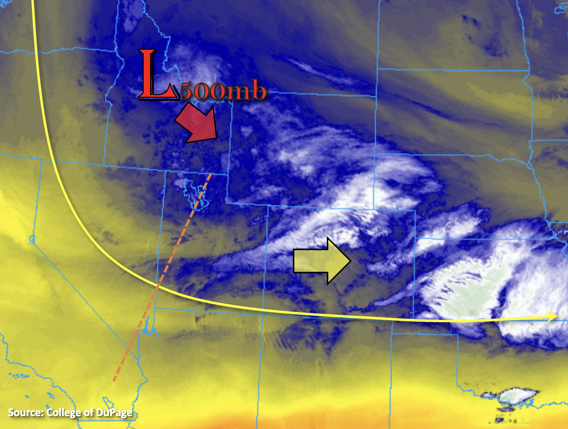
The trough of low pressure to our northwest will continue to influence Colorado’s weather today. Currently, there is precipitation and some fog being reported over the Central Mountains, Front Range, Palmer Ridge and eastern plains along with plenty of cloud cover. The low pressure system (marked below) is expected to move slowly south and then eastward throughout the day, which will produce strong westerly flow aloft across the state. With plenty of lift continuing due to the favorable dynamics overhead, beneficial precipitation is forecast for the majority of the state through tomorrow morning.
Cooler temperatures and PW around 0.50 inches both east and west of the Continental Divide mean instability will be limited, so more stratiform precipitation is forecast. Additionally, the snowline is expected to fall throughout the day and overnight night, so expect more snow for the mountains and elevated regions of the western slope and eastern plains by morning. Even if some weak embedded convection develops this afternoon and evening within the stratiform rainfall, only a slight increase in rain rates is forecast. Therefore, flooding is NOT forecast today. Finally, with snow forecast over the highest terrains and lower rain rates forecast before the crossover to snow for the mid-elevations, flooding over burn areas is not forecast.
Today’s Flood Threat Map
For more information on today’s flood threat, see the map below. If there is a threat, hover over the threat areas for more details, and click on burn areas to learn more about them. For Zone-Specific forecasts, scroll below the threat map.
Zone-Specific Forecasts:
Southeast Plains, Southeast Mountains, Raton Ridge, Northeast Plains, Front Range, Urban Corridor & Palmer Ridge:
Precipitation is forecast to pick up in coverage first north of I-70 this afternoon and evening, and then south of I-70 overnight and into tomorrow morning. Rainfall rates for the stratiform rainfall will be well under flood threat criteria, so flooding is NOT forecast. Isolated totals up to 1.50 inches will be possible over the northern Front Range/Urban Corridor by morning. Overnight, precipitation expands south and eastward. With rain turning to snow over the Southeast Mountains and elevated ridges, flooding is NOT forecast. Isolated totals by morning up to 2 inches (east) and 1.25 inches (west) are possible. Overall, this will be another system that brings beneficial precipitation to the spring soils.
Primetime: 10:30AM to ongoing
Northwest Slope, Northern Mountains, Central Mountains, Grand Valley, San Juan Mountains, Southwest Slope & San Luis Valley:
Slightly drier air will continue to protrude into the southwest corner of the state today (yellow shade above), so the lower elevations of the Southwest Slope will likely stay mostly dry. Only spotty rainfall coverage is forecast over the lower elevations of the Northwest Slope and Grand Valley this afternoon, and maybe a weak shower for the Northwest Slope tomorrow morning. Over the high terrains, expect a bit of a mix of rain and snow with precipitation accumulation favoring the Northern and Central Mountains. Totals by morning are generally expected to be between 0.50 and 0.75 inches with isolated totals just under 1 inch possible. Over the San Juan Mountains, general totals will be slightly less and with less coverage as well. The San Luis Valley could see a little precipitation if virga can make it to the valley floor tonight, but totals should remain under 0.10 inches. Flooding is NOT forecast.
Primetime: 11:30AM to Midnight