Issue Date: 7/22/2015
Issue Time: 9:00AM
Summary:
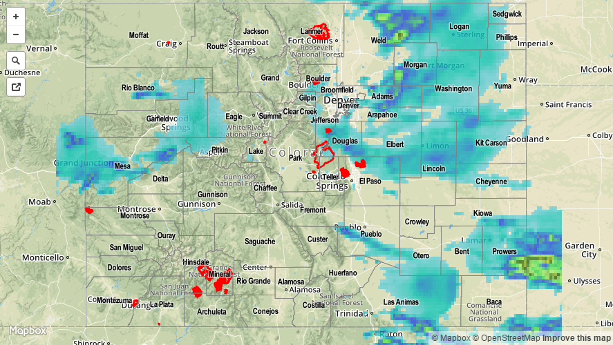
A potent disturbance skirted across Colorado early on Tuesday afternoon bringing with it thunderstorms. Most of the action was confined to northern and central Colorado, with areas within the Grand Valley all the way east to the Northeast Plains receiving over 1 inch of rainfall. The most impressive rainfall of the day was likely on the border of Douglas and El Paso county. There, a report of 2.75 inch per hour rainfall was received. Only a few miles to the north, one of our meteorologists noted some significant flooding on I-25 near Larkspur. Remarkably, these downpours appears to have been very spatially confined as the highest reports within several miles of there were only 1.0 – 1.3 inches.
Elsewhere, 1 or more inches of rainfall was officially tallied in the following list of counties: El Paso, Weld, Delta, Gilpin, Morgan, Prowers, Douglas, Arapahoe and Otero. Much of the rainfall fell over rural regions, and was not reported (but see our rainfall estimated total map below).
Aside from flooding, mud flow was reported in Rio Blanco County during the late afternoon. A brief tornado touched down in Weld County, hail just under 1 inch fell across El Paso County, and finally, a wind gust up to 70 mph was observed in Adams County around 3PM.
Be sure to check out our radar estimated rainfall totals, below, to determine approximately how much rain fell over your locale. Note that the rainfall totals in Douglas County appear to be significantly underestimated, and will require gage-based adjusting. This typically takes a few hours to as long as a day to complete.