Issue Date: Monday, September 28th, 2020
Issue Time: 2:30PM MDT
Valid Dates: 9/29 – 10/13
This is the last FTO for the 2020 season.

A prolonged dry period is the most on point way to end this flood season, due to the well below average precipitation that has occurred this year. An amplified ridge has set up over the western US, and this ridge will remain in place through early next week. This should keep a very dry air mass overhead. Northwesterly and northerly flow will push mid-level energy through the state on and off this week. Rather than increasing the chances for precipitation as they pass through, they will only help keep temperatures more seasonable. The first of the cold fronts drops through on Wednesday, and the next, over this weekend. Precipitation chances look like they may increase as the ridge begins to break down early next week (for a day). However, only very light precipitation will be possible along the northern Continental Divide, and there is an equal chance that no precipitation occurs. That means No Apparent threat is issued for the last event of the warm season.
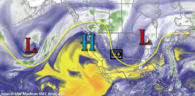
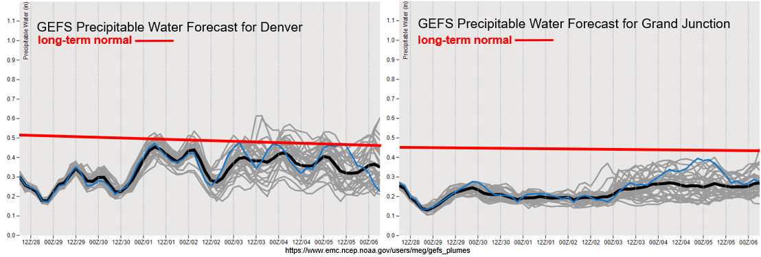
It will be very dry this next week over western Colorado, where PW (right) remains well below average. This is due to the dry air mass (yellow above) being pushed overhead with the eastward movement of the High. During the first part of the week, surface winds will start to die down; however, by this weekend, elevated fire conditions are possible as a jet streak potentially sets up over the state again.
To the east, PW remains below average with some variation in model solutions by the end of the week. Either way, PW values will likely remain near or below normal (0.50 inches), which will keep rainfall out of the forecast. Stronger surface winds may mix down the surface later this week as the jet meanders, so there is a possibility for elevated fire conditions. This will be tracked in the daily FTBs through Wednesday.
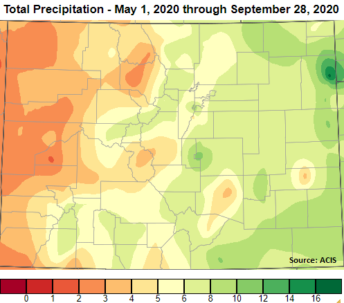
Below is a quick look at the total precipitation that has fallen from May 1st to present. Much of western Colorado has received less than 4 inches of precipitation for the period, but a couple large precipitation events over the San Juan Mountains boosted them into the 6 to 8 inch range. Also, distinctive in the map is the bulls-eye over Yuma County. Extreme rainfall fell over that area on July 23rd, and 6.3 inches was observed in Wray. So, this added a significant amount to the total precipitation for the period.
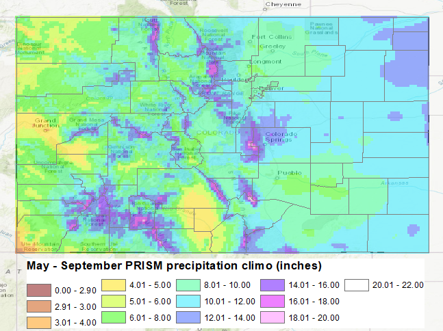
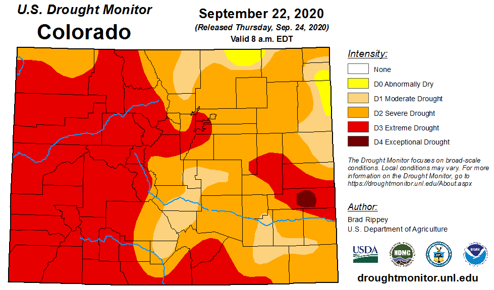
Below the first image (middle) is the average precipitation from May to September from PRISM (30-year normal). Overall, Colorado had well below average precipitation for the season. This led to an extended and worsening drought (bottom image). At the start of the season, only 11% of the state was in D3-D4 category. That percentage has increased 38%, and now half of the state has reached the D3-D4 category. At the beginning of the season, only 23% of the state was under no drought conditions, but that dropped to 0% by August after a quiet monsoon season. Not surprisingly, this led to a very active fire season and two new fires (Pine Gulch and Cameron Peak) broke into the top 3 largest Colorado wildfires of all time.
Event #1: Monday – Tuesday (10/5 – 10/6)
No Apparent flood threat as the ridge breaks down and returns minimal moisture to state.
No map has been drawn since it is highly likely precipitation totals will remain below 0.50 inches, and possibly, no precipitation at all will be recorded for this event. Best chance for some accumulation will be along and near the northern half of the Continental Divide. A rain/snow mix may be possible due to cooler temperatures at the highest elevations. As expected, there is No Apparent flood threat issued.