Issue Date: Sunday, September 20th, 2020
Issue Time: 09:45AM MDT
— Flooding is NOT expected today
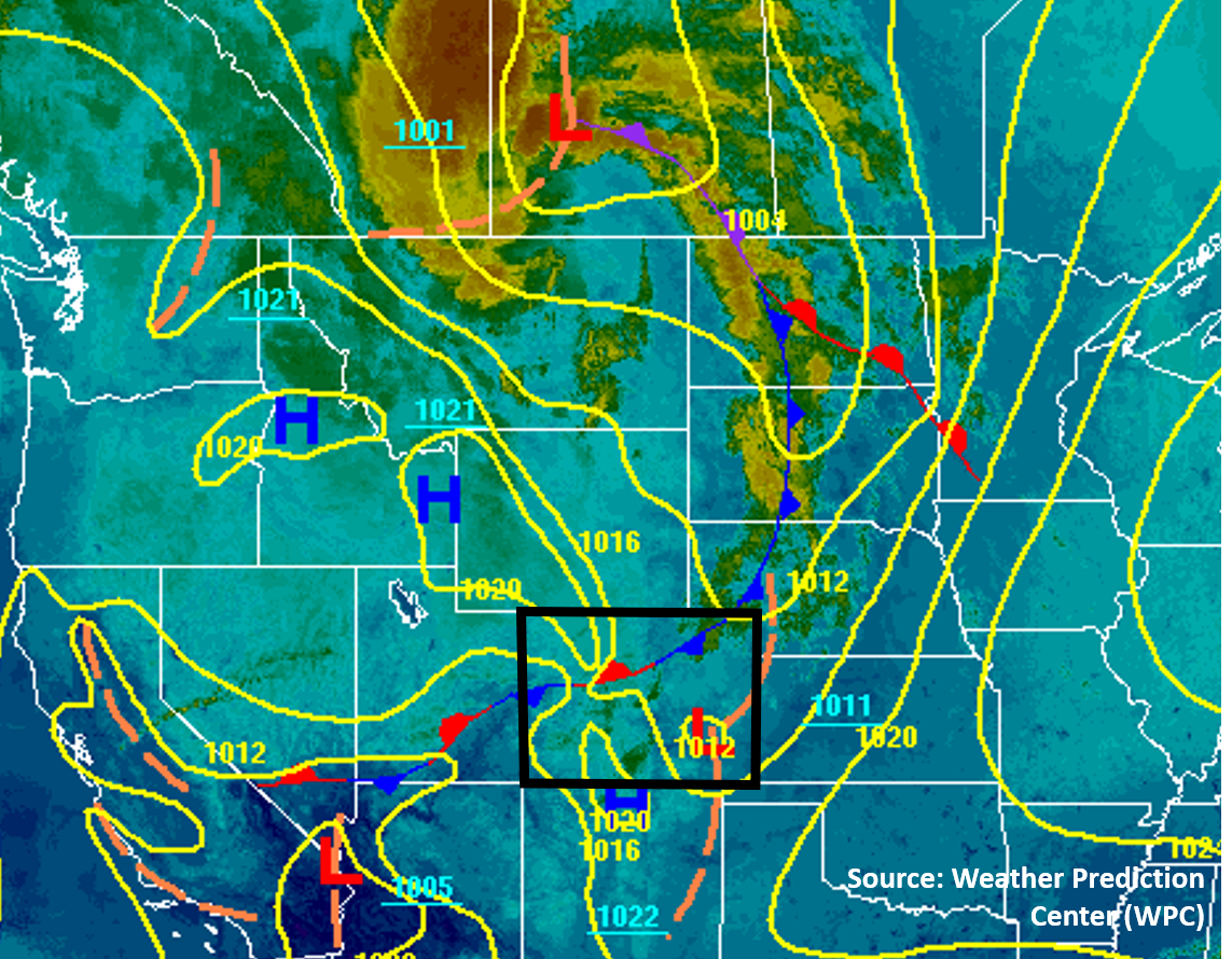
The trough that impacted Colorado yesterday will continue to impact Colorado weather today as it skims the northern edge of the state. The image below shows this morning’s surface analysis with the infrared satellite imagery, which shows a large Low pressure system associated with the advancing trough now centered in Saskatchewan, Canada. A frontal boundary extends south from this Low through central Colorado, which has stalled out over the mountains. This frontal boundary will be the focus of some light precipitation today as the main storm energy stays well north of Colorado. The frontal boundary that worked its way into Colorado did not seem to bring significant moisture with it, but surface dew points have risen into the low 40Fs for the Northwest Slope region. Dew points are also in the 40Fs across much of the plains of eastern Colorado as well, with 30Fs dew points over the Palmer Ridge. The Denver sounding shows a slight increase in PW compared to yesterday, up to 0.61 inches. This limited moisture will be enough to allow some showers to develop across the central and northern part of the state, but strong upper-level winds will keep these showers moving quickly to the east. No flooding is expected today.
Today’s Flood Threat Map
For more information on today’s flood threat, see the map below. Hover over the threat areas for more details, and click on burn areas to learn more about them. For Zone-Specific forecasts, scroll below the threat map.

Zone-Specific Forecasts:
Northeast Plains, Urban Corridor, Palmer Ridge, Raton Ridge, & Southeast Plains:
It will be warm again today with high temperatures increasing from the low 80Fs along the northern border to the low 90Fs in the Southeast Plains. Showers will likely develop over the Palmer Ridge, Northeast Plains, and Urban Corridor this afternoon near a stalled frontal boundary. These showers will not produce significant rainfall as there is limited moisture and strong winds pushing them east quickly. Total rain accumulations should stay under 0.1 inches from these showers. The Southeast Plains will likely stay dry, but western portions of the region may get a few sprinkles from showers coming off the higher terrain. No flooding is expected today.
Some smoke an active wildfire in southern Wyoming is affecting air quality over the northern plains regions. An Air Quality Alert has been issued for some of the northern counties. See your local NWS office for more information. Elsewhere, the trough has pushed out some of the thicker smoke to our east, so skies should be somewhat clearer today than it has been over the last week.
Primetime: 1PM to 10PM
Grand Valley, Northwest Slope, Northern Mountains, Front Range, Central Mountains, Southwest Slope, San Juan Mountains, Southeast Mountains, & San Luis Valley:
Most valleys will stay dry and warm again today, but some showers are possible over the mountains. The highest chances for seeing rainfall is over the northern San Juan and Southeast Mountains where the stalled frontal boundary will increase convergence and lift. Any showers that form will move east quickly under the strong upper-level winds, which will limit rain totals. Up to 0.2 inches of total rain accumulation could fall over the favored northern San Juan and Southeast Mountains. The drier low-level atmosphere will favor this rain accumulation over the higher elevations as evaporation will likely lower rain accumulations for low elevation locations. No flooding is expected.
Primetime: 12PM to 8PM