Issue Date: Tuesday, September 15th, 2020
Issue Time: 9:30AM MDT
Summary:
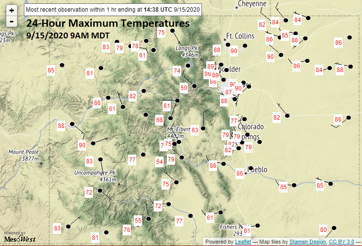
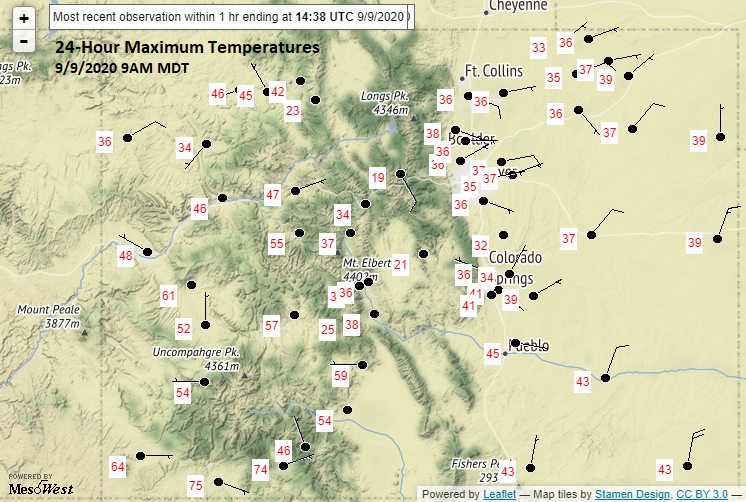
Not much else to talk about other than the above average temperatures for mid-September with this ridging pattern. On Monday, some cloud cover formed over the mountains during the afternoon/evening hours and produce a few sprinkles, but observations are all below 0.05 inches. This was likely due to the dry surface layer increasing evaporation, since most of the moisture was in the mid-layers. Below (top) are the 24-hour maximum temperatures from NWS ASOS stations across the state. It’s been quite warm, and for comparison, I have the 24-hour maximum temperatures from last Wednesday morning (Tuesday’s highs). Just wanted to show what an impressive rebound it has been since last week’s snow storm and freeze. Highs will continue to stay above average until this weekend when the next Low pressure system moves onshore from the west. This next system will also help to reduce the near surface smoke that will likely build up over the next couple of days.
Ongoing Colorado wildfires update (as of 9:30AM from InciWeb):
Thankfully, the ongoing fires haven’t flared up with the warmer temperatures and drier conditions. The lack of wind has surly helped. Due to the high containment of the Pine Gulch and Grizzly Creek fires, they have been removed from this update. Those fires can still be tracked on InciWeb: https://inciweb.nwcg.gov/
Cameron Peak in the Medicine Bow Mountains: 102,596 acres; 4% contained
Williams Fork in the Arapaho National Forest: 12,157 acres; 10% contained
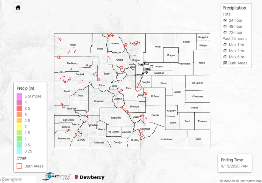
With precipitation estimates under 0.25 inches over the last 72-hours, the State Precipitation Map below looks blank.
Click Here For Map Overview