Issue Date: Saturday, September 12th, 2020
Issue Time: 09:35AM MDT
Summary:
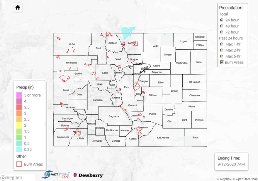
Some light rain & snow showers impacted the northern Front Range and plains yesterday from wrap-around moisture associated with the departing Low. QPE sources (MetStormLive and MRMS) indicate near and just over 0.25 inches of precipitation fell since 6am yesterday over northern Larimer County. Some of this precipitation may have fallen as snow over the higher elevations near the Continental Divide, but most locations got above freezing yesterday. A couple MesoWest stations in western Larimer County show 0.41 to 0.48 inches of precipitation fell yesterday morning and early afternoon, but these automated stations may be suffering from snowmelt from previous days as this accumulation period was co-located with temperatures climbing above freezing. Regardless, this precipitation is welcomed near the Cameron Peak wildfire. Less than 0.20 inches of accumulation generally fell in northern Weld County according to QPE, but the highest rain gauge accumulation found was 0.08 inches from a Weather Underground station.
Some gusty winds were generated along the Continental Divide in the Front Range as the stronger winds from the upper-level Low moved over the area. Berthoud Pass saw a wind gust up to 60 mph, and other automated weather stations near or just east of the Divide saw gusts in the 40 mph range. These winds appear to be dying down this morning. Fortunately the recent moisture has lessened the impact of these stronger winds as all the major fires burning in Colorado have remained in the smoldering stage with no additional growth (see info below). Firefighters have been and are continuing work on increasing containment of these fires during this more favorable weather window, but increasing temperatures and little precipitation over the next week will not help make the fire situation much better.
Ongoing Colorado wildfires update (as of 9:25AM from InciWeb):
Cameron Peak in the Medicine Bow Mountains: 102,596 acres; 4% contained
Williams Fork in the Arapaho National Forest: 12,157 acres; 10% contained
Grizzly Creek in Glenwood Canyon: 32,431 acres; 91% contained
Pine Gulch north of Grand Junction: 139,007 acres; 95% contained
For precipitation estimates in your area over the last 24 to 72 hours, check out our State Precipitation Map below.
Click Here For Map Overview