Issue Date: Thursday, September 10th, 2020
Issue Time: 2:45PM MDT
Valid Dates: 9/11– 9/25
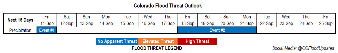
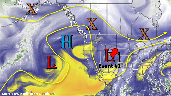
Event #1 is a quick one-day event as the upper Low continues to lift to the northeast. Some scattered, lingering snow showers are possible over the northern mountains tomorrow morning, but it should clear up by midday. There may also be some light, wrap around precipitation over the northeast corner of the state during the afternoon, but other than that, it should remain dry. There is No Apparent flood threat. Winds are also expected to pick up over the mountains and Southwest Slope during the afternoon as the jet moves overhead, so some elevated fire weather may be possible. Cooler temperatures may help alleviate this hazard, but be sure to tune into the FTB tomorrow morning.
A ridge begins to build back over the western US this weekend and will hang through next week, so mild weather is on tap. A lot of variation from model run to model run in strength and timing, but it looks like the next Low will drop in sometime at the end of next week (Event #2). This will bring precipitation chances back into the forecast.
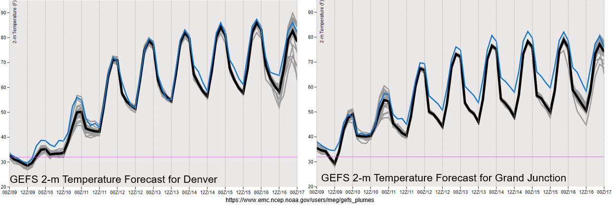
As this ridge builds in from the west tomorrow, there will a sharp increase in temperatures across the state the next couple of days, which is shown below. There’s a bit more of a diurnal swing over the western Colorado (right), but overall, we are looking at temperatures returning to more seasonal values by Sunday. The early season snowstorm will seem like a distant memory by Tuesday as high temperatures will be back in the upper 80Fs. Feeling confident about the increase in temperatures due to good model member agreement through the forecast period.
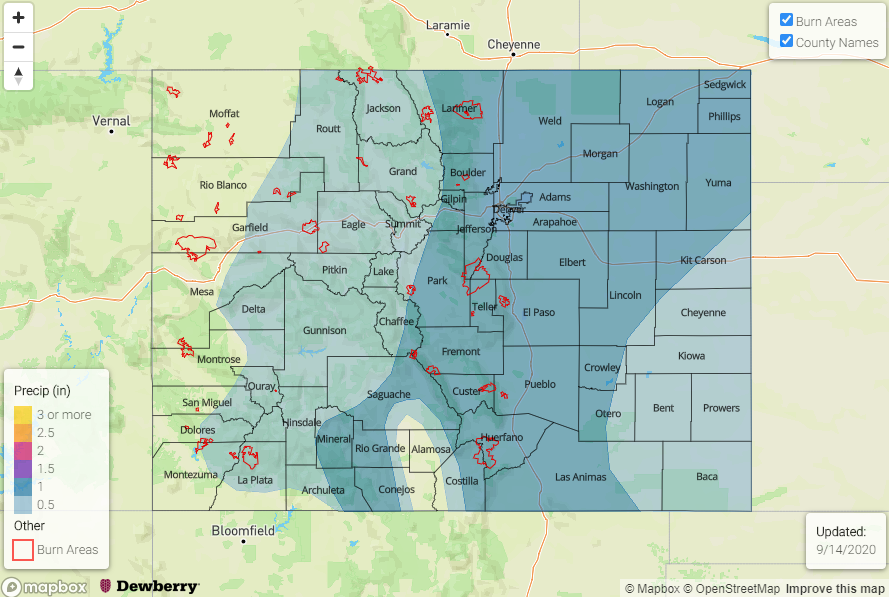
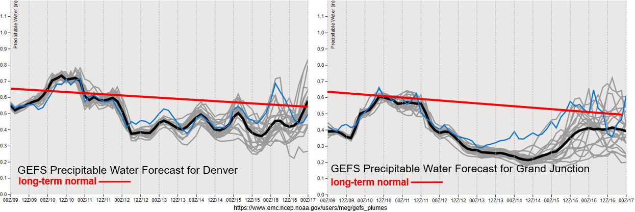
PW really drops off after tomorrow morning (western Colorado) as the Low tracks to the northeast. With PW dropping to well below normal values going into this weekend, rainfall is not in the forecast. PW drops off over eastern Colorado after tomorrow morning, and subsidence behind the Low should keep rainfall chances low. It’ll be a stretch of warm and dry weather for most of the week. The change in the weather pattern can be seen on the tail end of the PW forecasts, but the large disagreement between members on moisture return means there’s a chance for very little rainfall. If this is the case, there may be some increased fire weather towards the end of the week. With PW looking to stay below 0.75 inches for the worst case scenario, there is No Apparent flood threat for Event #2 at this time.
Event #2 Friday – Monday (9/18 – 9/21)
No Apparent flood threat as the next Low breaks down the ridge and returns some higher moisture to the state for some afternoon rainfall.
Some models are showing an open wave, while other models are showing another cut off Low. Either way, chances for precipitation will increase towards the end of this week. It will be a much warmer system than this last event, so expecting all rainfall at this point in time. Global models are also showing different timing for the arrival, but this will likely only be two to three-day event during this period. A lot of details will change due to it starting 160 hours from now, so there is Low confidence in the details. The precipitation map below shows a higher end rainfall scenario mostly from the GFS.