Issue Date: Thursday, September 10th, 2020
Issue Time: 10:25AM MDT
Summary:
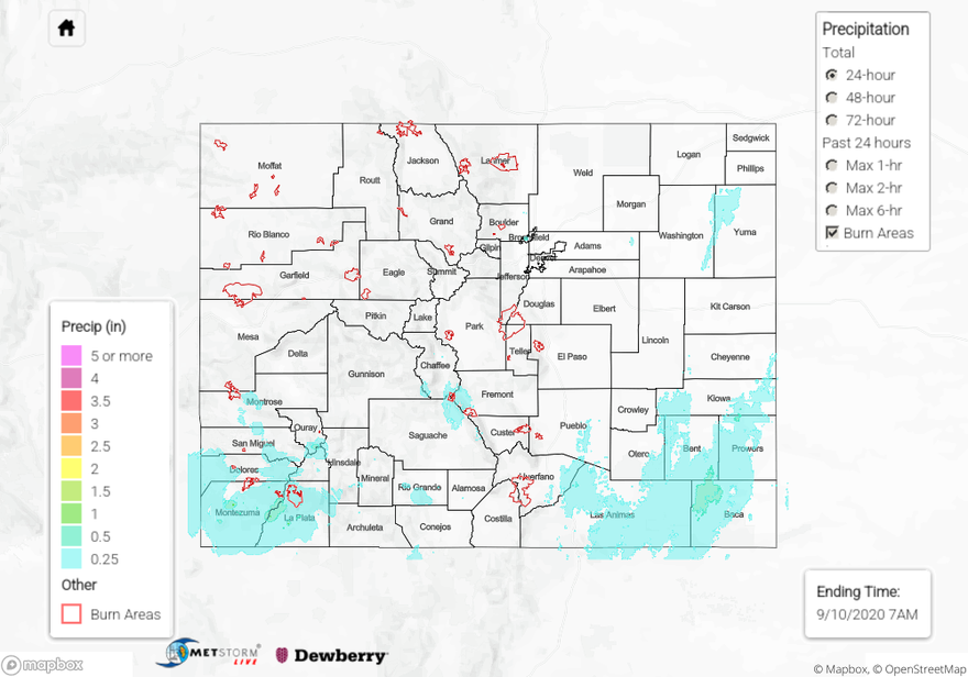
Rain and snow fell over mainly the southwest and southeast parts of Colorado yesterday, with much of this precipitation falling after sunset. Total precipitation reports from CoCoRaHS observers in Montezuma and La Plata counties in the Southwest Slope exceed 1 inch over the last 24 hours, with up to 1.26 inches reported. These reports indicate only a small fraction (<10%) fell as snow. Liquid-equivalent precipitation up to 0.61 inches was reported in the San Luis Valley, with 3-5 inches of wet snow falling in some locations. The QPE map shows that over 0.5 inches of precipitation fell over northwestern Baca County in the Southeast Plains. Temperatures were above freezing over the Southeast Plains yesterday, so much of this precipitation likely fell as rain.
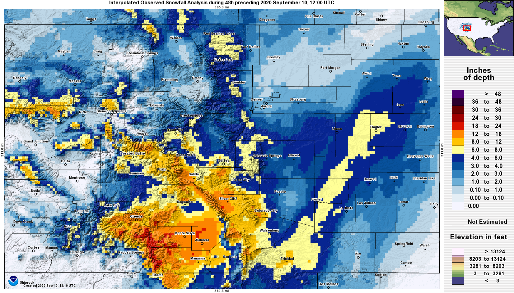
The precipitation over the last two days brought much of Colorado at least 0.5 inches of liquid (see 48-hour QPE map), with some locations receiving over 1 inch (southern mountains & Grand Valley). For parts of the southern San Juan Mountains and even into the San Luis Valley, this has translated into 12-24 inches of snow (see 48-hour snowfall analysis image below; Source: NOHRSC). The slightly warmer near- to above-freezing temperatures over the Urban Corridor and plains regions cut down on snow accumulation significantly, with less than 3 inches reported in many locations. A band of heavier snow was able to drop 6-8 inches of snow from western Las Animas County northeastward to western Kit Carson County, but these were the highest totals observed over the plains. Even the Front Range had less-than-expected totals of up to only 8 inches. However, all this moisture and snowfall has been extremely helpful to suppress wildfires, at least for now. Up to 18 inches of snow fell over the Pine Gulch fire, up to 12 inches fell over the Grizzly Creek fire, up to 8 inches fell over the Cameron Peak fire, and up to 2 inches fell over the Williams Fork fire.
Large Colorado wildfire update (as of 10:20AM on InciWeb):
Cameron Peak in the Medicine Bow Mountains: 102,596 acres; 4% contained
Williams Fork in the Arapaho National Forest: 12,157 acres; 10% contained
Grizzly Creek in Glenwood Canyon: 32,464 acres; 91% contained
Pine Gulch north of Grand Junction: 139,007 acres; 95% contained
For liquid-equivalent precipitation estimates in your area over the last 24, 48, and 72 hours, check out our State Precipitation Map below.
Click Here For Map Overview