Issue Date: Saturday, September 5th, 2020
Issue Time: 8:55AM MDT
Summary:
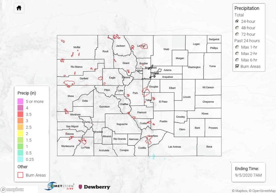
Temperatures started rebounding quickly yesterday after a couple days of cooler weather. Highs reach the 90Fs over the plains and western valleys, 90Fs along the urban corridor and 80Fs in most of the lower elevation mountain towns. Fair weather cumulus formed over the southern mountains yesterday afternoon with a couple showers over the Southeast Mountains. Totals were mostly trace amounts to 0.10 inches with slightly higher totals (up to 0.25 inches) over the Raton Ridge/Southeast Mountain intersect on the southern border indicated by radar. Near surface smoke continued to be an issue for the Cameron Peak fire. Hopefully there won’t be too much growth tomorrow afternoon with a Red Flag Warning in place for most of northern Colorado (including the plains).
Ongoing large fire update (as of 8:45AM on InciWeb):
Cameron Peak Fire in the Medicine Bow Mountains: 23,903 acres; 6% contained
Williams Fork Fire in the Arapaho National Forest: 12,125 acres; 10% contained
Pine Gulch Fire north of Grand Junction: 139,007 acres; 87% contained
Grizzly Creek Fire in Glenwood Canyon: 32,464 acres; 83% contained
To see precipitation estimates over your neighborhood the last 24-hours, scroll down to the State Precipitation Map below.
Click Here For Map Overview
