Issue Date: Friday, September 4th, 2020
Issue Time: 09:40AM MDT
— Flooding is NOT expected today
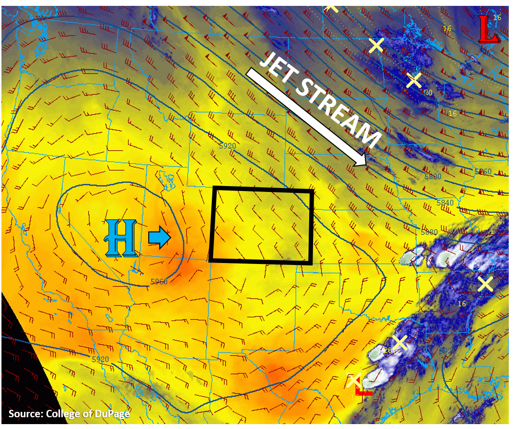
Today will be very similar to yesterday, but a slight increase in the chance for a few raindrops exists over the high elevations of the southern mountains. Colorado remains pinned between a broad trough to the northeast and a high pressure ridge to the west (see image below). This high pressure ridge will again drift eastward towards Colorado today, keeping dry and warm weather in the forecast. This morning’s soundings show it is fairly dry over the western half of Colorado, with dew points in the 20Fs and 30Fs. The Grand Junction sounding shows a PW value of 0.3 inches, which is in the bottom 10% in terms of normal this time of year. The water vapor satellite image below shows mainly dry air encompassing much of the US West and Colorado (red/yellow colors). However, some weak surface moisture has worked its way across northern New Mexico and into the southern San Juan Mountains overnight. Dew points are a degree or two higher this morning compared to yesterday over this area. This slight increase in moisture will increase the chances for seeing clouds and maybe even a quick light shower or two over the high terrain of the southern San Juan, Central, and Southeast Mountains, but chances are still very low for accumulating rainfall due to the expected high cloud bases and limited moisture. A brief gust of wind up to 30 mph could accompany any shower that is able to generate some raindrops. The rest of the state should stay dry with high temperatures on the rise. No flooding is expected today.
Today’s Flood Threat Map
For more information on today’s flood threat, see the map below. Hover over the threat areas for more details, and click on burn areas to learn more about them. For Zone-Specific forecasts, scroll below the threat map.

Zone-Specific Forecasts:
Grand Valley, Northwest Slope, Northern Mountains, Central Mountains, Southwest Slope, San Juan Mountains, & San Luis Valley:
There will be plenty of sunshine and some smoke around today over the northern half of these zones. Temperatures should climb to above average again with high temperatures topping out in the mid 90Fs for the lower elevations of the Grand Valley. Surface winds should remain weak today as the high pressure ridge shifts east over the area, so fire danger remains lower. With diurnal heating, up-mountain slope flows will cause mountain-top convergence and some clouds to form over the southern mountain regions. A few of these clouds may be able to generate some raindrops, but plenty of sub-cloud evaporation should limit any rain accumulation to only the high elevations. Max rain rates over these high terrains should stay below 0.2 in/hr with most totals under 0.1 inches. No flooding is expected today.
Primetime: 3PM to 7PM
Northeast Plains, Urban Corridor, Front Range, Palmer Ridge, Raton Ridge, Southeast Mountains, & Southeast Plains:
Mainly sunny for the eastern half of Colorado, but smoke from the Cameron Peak fire will continue to build up and lower air quality over the Urban Corridor. Surface winds will remain weak today as the jet stream stays well northeast of Colorado and Colorado gets engulfed more into the high pressure ridge. This will continue to keep the fire danger lower, but the dry conditions mean wildfires will still be able to burn easily. Additional smoke from other western US wildfires will also move into Colorado today, especially over the northern and eastern regions.
Temperatures will rise above average again today, with high temperatures into the upper 80Fs and low 90Fs forecasted. Some clouds and a few raindrops are possible over the high terrains, especially the southern Front Range and Southeast Mountains, but a cap should limit any precipitation from falling over the plains regions. Max rain rates should stay below 0.1 in/hr over the high elevations. No flooding is expected today.