Issue Date: Thursday, September 3rd, 2020
Issue Time: 10:05AM MDT
Summary:
Not much in terms of interesting weather happened in Colorado yesterday as even clouds were hard to find. Temperatures were slightly above average, with Denver adding to its tally of 90 degree days this year with a high of 92F. Grand Junction reached 89F, a few degrees above average, but woke up to some below average morning low temperatures of 50F. The large diurnal swing in temperature was possible due to the much drier air over Colorado yesterday, with relative humidity dropping to 10-20% for many locations across the state. Some gusty afternoon winds up to 30 mph were also present over the Northern Mountains and Front Range. Luckily, these winds did not cause significant issues for the current wildfires (see update below).
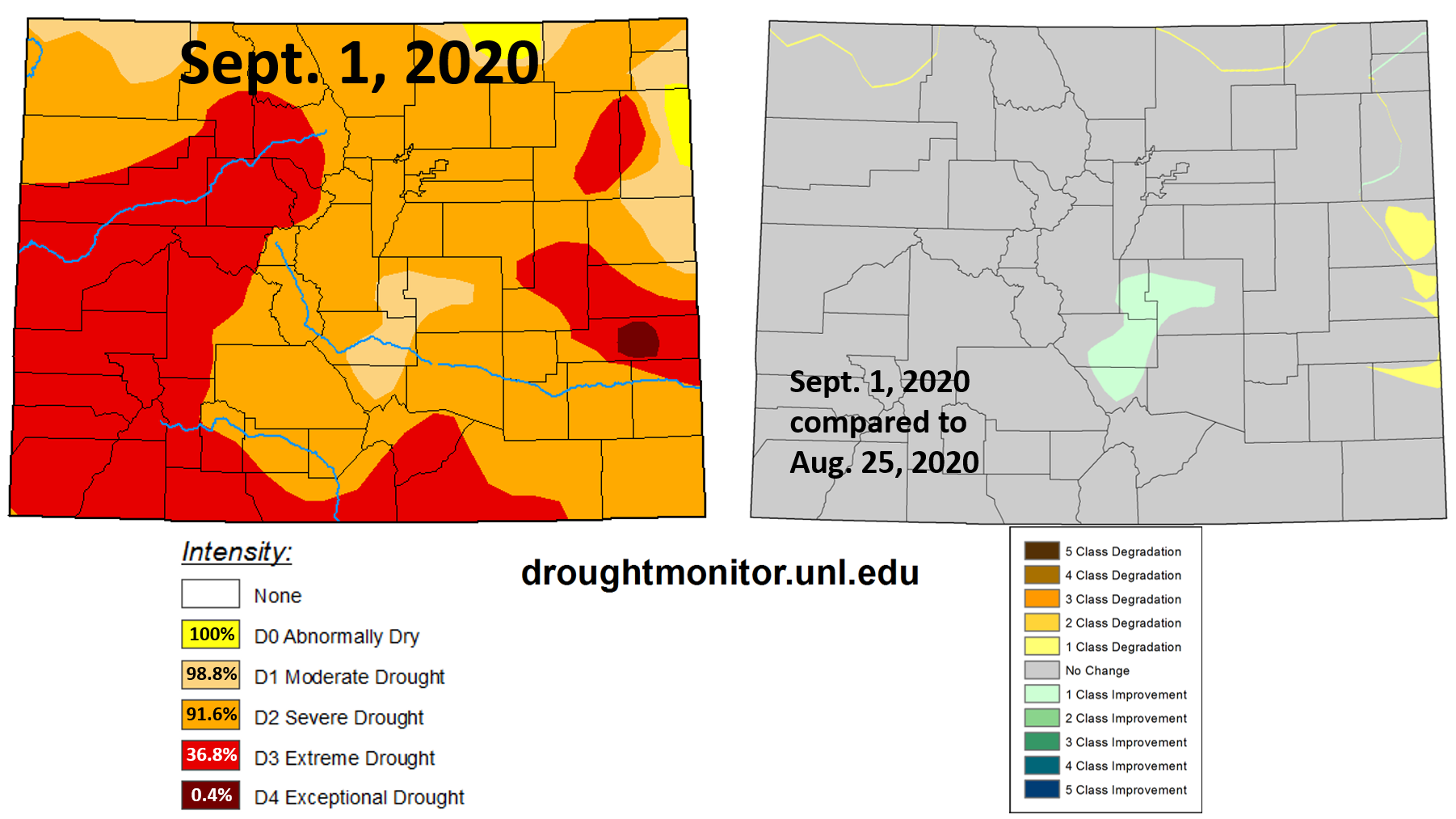
Today’s newly released US Drought Monitor maps (see image below) show that Colorado is still dealing with moderate (98.8% of area) to exceptional drought (0.4% of area) as of September 1st, 2020. A small area of drought improvement occurred along the southern Front Range and northern Southeast Mountains regions (see right panel of image below), but this area is still experiencing moderate drought conditions. Rain gauges in this area indicate up to 1.5 inches of rain fell over the week (25 Aug. through 1 Sept.). Unfortunately, the dry weather this week and over the weekend will likely allow the drought conditions to remain.
Colorado large wildfire updates (as of 9:00AM on InciWeb):
Pine Gulch – north of Grand Junction: 139,007 acres; 81% contained
Grizzly Creek – Glenwood Canyon: 32,464 acres; 82% contained (increased containment)
Cameron Peak – Medicine Bow Mountains: 23,037 acres; 6% contained (small increase in size & containment)
Williams Fork – Arapaho National Forecast: 12,097 acres; 10% contained
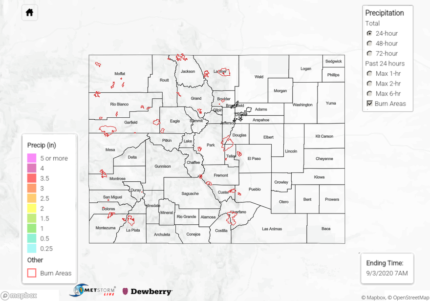
To see rainfall estimates back to 72 hours, check out our State Precipitation Map below.
Click Here For Map Overview