Issue Date: Wednesday, September 2nd, 2020
Issue Time: 09:40AM MDT
Summary:
Yesterday remained dry for most locations across Colorado, with only a couple morning showers and weak afternoon convective cells over the southern mountains. The morning showers produced up to 0.16 inches of rain near the Great Sand Dunes National Park according to rain gauges. The weak afternoon convection fired over remote western Las Animas County, along the border between the Southeast Mountains and Raton Ridge, but QPE only indicates up to 0.25 inches of rain fell. Stronger convection remained south of the Colorado border in New Mexico. No flooding was reported in Colorado yesterday.
Temperatures across the state yesterday were well below climatological average. Denver only got up to 80F (4F below normal), and Grand Junction only got up to 78F (8F below normal). Leadville, at 10,152 ft above sea level, barely got out of the 50Fs for a high. These cooler temperatures are a welcome relief to the record August heat we’ve been experiencing.
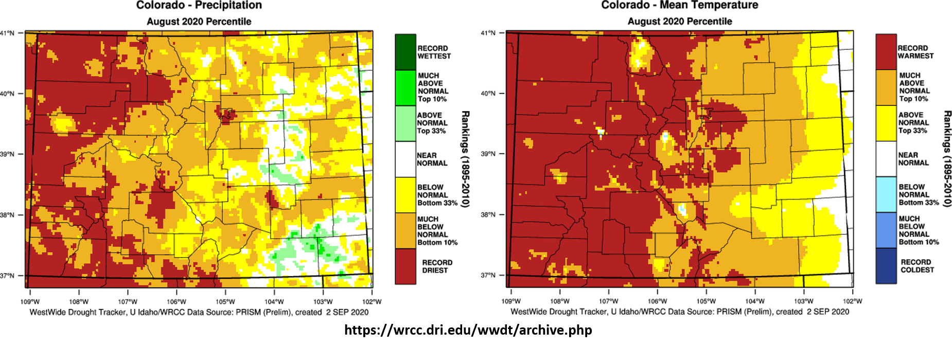
Taking a look back at the full month of August, most of Colorado experienced below normal to record driest precipitation (left panel on image below). The western slope experienced the driest conditions with most of the area in record driest territory. Isolated locations along the plains of eastern Colorado were actually able to get above normal precipitation for the month. This is due to some of the strong thunderstorms that dropped heavy rain over the plains during the first week and the last few days of the month, which was able to tap into more moisture from the east. However, with the record heat of August 2020 (right panel on image below), severe drought conditions were able to expand drastically across the state, as pointed out in the FTO last Thursday. This also made the 2020 wildfire season one of the more active in recent years, with the largest Colorado wildfire now in the record books (Pine Gulch Fire). Note that increased moisture along the eastern Colorado border likely allowed these locations to remain near normal in terms of temperature. The absence of a strong monsoon kept moisture low and temperatures high in western Colorado. Grand Junction only received 0.07 inches of rain over two days at the end of August, which is 7% of their normal 0.95 inch monthly total.
Colorado large wildfire updates (as of 9:00AM on InciWeb):
Pine Gulch – north of Grand Junction: 139,007 acres; 81% contained
Grizzly Creek – Glenwood Canyon: 32,464 acres; 75% contained
Cameron Peak – Medicine Bow Mountains: 23,022 acres; 5% contained
Williams Fork – Arapaho National Forecast: 12,097 acres; 10% contained
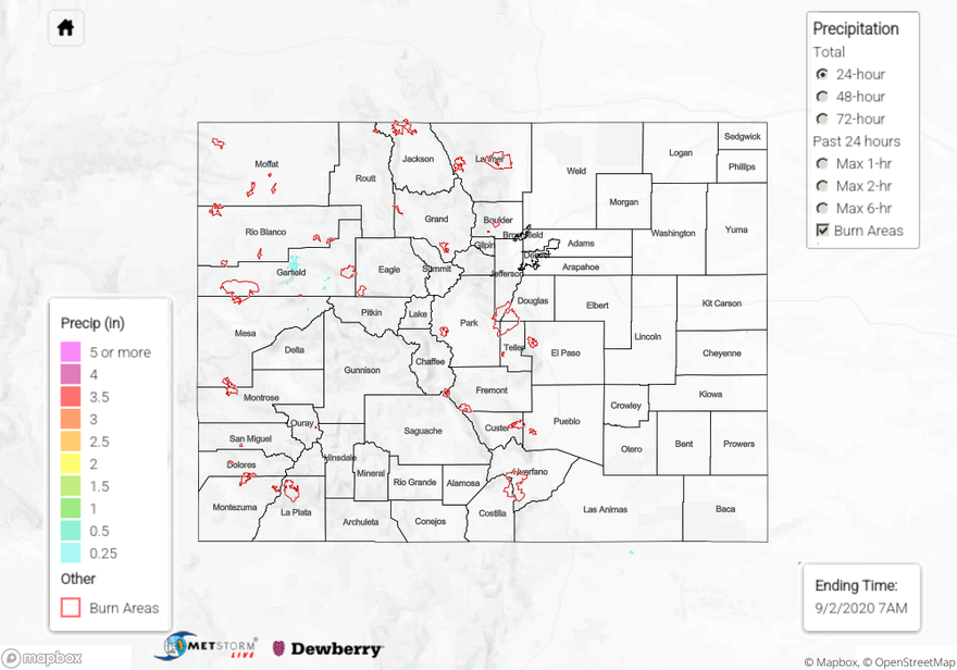
For rainfall estimates in your area over the last 24 to 72 hours, check out our State Precipitation Map below.
Click Here For Map Overview