Issue Date: Tuesday, September 1st, 2020
Issue Time: 10:05AM MDT
— Flooding is NOT expected today
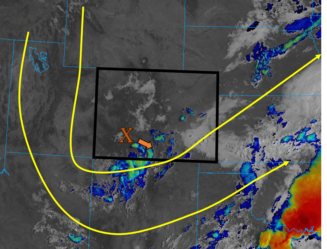
A strong shortwave that moved into Colorado late yesterday and produced overnight mountain rainfall and light snow will continue to move southeast and exit the state along its southern border. This upper Low is creating some clouds and light showers over the southern San Juan Mountains and Southeast Mountains this morning (blue/green on satellite image below), and will be the focus of any precipitation that forms today. Leftover surface moisture remains over the state this morning with dew points in the 30Fs and 40Fs over the mountains and 50Fs over the plains. The highest moisture is over the Southeast Plains where low-level clouds are present this morning (white on satellite image below).
This morning’s Grand Junction sounding shows that there is drier air aloft behind this Low. This drier air, paired with sinking motion, will keep precipitation chances low for much of the state today. The best chances for precipitation will be over the southern San Juan and Southeast Mountains as the shortwave energy moves over the area. A surface low pressure is expected to develop over the Oklahoma panhandle, which will allow some moisture to remain pushed up against the Southeast Mountains and Southeast Plains. This moisture, along with daytime heating, will allow some additional storms to fire over the far southern portions of the San Juan and Southeast Mountains later this afternoon and evening. The strongest cells further south could produce brief, heavy downpours if some instability can build, but flooding is not expected today due to the small coverage of the stronger storms. The southern end of the Spring Creek burn area will be close to these convective cells, but with limited instability further north, increased lift further south (Raton Ridge) has a higher likelihood for the heavier rain rates (0.75 in/hr).
Today’s Flood Threat Map
For more information on today’s flood threat, see the map below. Hover over the threat areas for more details, and click on burn areas to learn more about them. For Zone-Specific forecasts, scroll below the threat map.

Zone-Specific Forecasts:
Raton Ridge, Southeast Mountains, San Juan Mountains, Southeast Plains, & San Luis Valley:
Convective showers and some isolated storms will likely fire this afternoon over the high terrains of the San Juan and Southeast Mountains. The strongest of these storms could produce isolated rain rates up to 0.75 in/hr over the southern portion of the Southeast Mountains near the Raton Ridge. Drier air and a less favorable location behind the departing shortwave will keep rain rates lower over the southern San Juan Mountains (up to 0.4 in/hr). No flooding is expected over the mountain regions as storms should stay closer to the CO/NM border and away from the more vulnerable Spring Creek burn area. As always, if a storm does track over the burn area, flash flooding, mud flows, and debris slides could occur.
Low-level clouds this morning should help reinforce a cap over the Southeast Plains and prevent large amounts of instability from building. However, there is a slight chance that storms could fire over the border counties, but not seeing any well-defined feature to help break the cap at this moment. If storms do fire, they could produce isolated areas with rain rates up to 1 in/hr. No flooding is expected with these storms, and they should move southeast out of the state with the departing shortwave.
Primetime: 12PM to 8PM
Grand Valley, Northwest Slope, Northern Mountains, Central Mountains, Southwest Slope, Northeast Plains, Urban Corridor, Front Range, & Palmer Ridge:
Today should be mainly sunny for most regions, with high temperatures around 5F below normal. However, temperatures have cooled down about 8F to 15F from yesterday at this time. Drier air will be mixing its way down to the surface as the fall-like shortwave system moves out of Colorado, which will limit rainfall chances. Clouds should form over the high terrains this afternoon, but the only chance for measurable rainfall will be over the southern Central Mountains and Front Range. Rain totals should stay under 0.10 inches, so no flooding is expected today. Enjoy the cool down because it’s about to heat back up again this week.