Issue Date: Monday, August 31st, 2020
Issue Time: 1:40PM MDT
Valid Dates: 9/1– 9/15

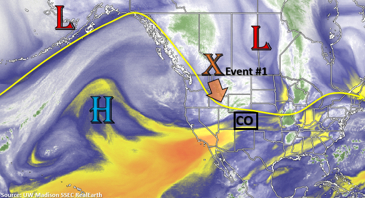
An upper shortwave trough will continue to plunge south and cut itself off from the main flow by tomorrow (Event #1). This feature will bring some cooler temperatures to western Colorado as well as some overnight rainfall for the mountains on Monday. By Tuesday morning, the rainfall and upper level energy will be over the southern mountains. As the rain pushes east into the Southeast Plains and the Raton Ridge by mid-morning, some cloud cover and light rainfall should be expected. Tomorrow afternoon, outside of a chance for rainfall over the Southeast Mountains and southern San Juan Mountains, it should be dry and cool across the state. There is No Apparent threat for this event, although rain rates will be watched closely as storms could form over the recent burn areas in the Southeast Mountains. Rain rates will be dependent on how much instability can form after the shortwave moves through.
Dry northwest flow will fill in behind the shortwave trough as the High builds into NV/CA. As the subtropical High strengths throughout the week, dry and warm conditions are forecast. Occasional weak fronts will likely move through the northwest flow, which could briefly cool the afternoon temperatures over eastern Colorado. It looks to heat up and stay warm out west until a strong front moves through at the end of this weekend on the east side of an amplified ridge pattern. There’s low confidence in Event #2, but if it does occur, it will likely be short-lived.

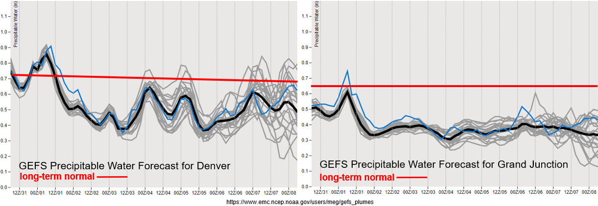
PW values plummet after the shortwave moves through, and both areas east and west of the Continental Divide are at below normal values by tomorrow afternoon. PW stays well below normal over western Colorado through the end of this week, so there will be little to no chance for rainfall. Thankfully under the ridging pattern, surface winds should stay milder. However, warming temperatures and low relative humidity will keep fire danger elevated with the overly dry fuels.
There’s a slight increase in PW over Denver mid-week, which is likely from a weak front moving through the area. This may return scattered, weak showers to the mountains, but with a dry boundary layer, little to no rainfall is forecast at this time. The next increase in PW (Event #2) at least has the potential to return higher PW values to the plains, which could increase the chances for some moderate rainfall. This would only occur if the system has decent low-level moisture return and the front drops through the state at the right time of day. There’s low confidence in both of these forecast elements this far out.

Event #1: Tuesday (9/1)
No Apparent threat as isolated storms return to the southern mountains behind the passing trough.
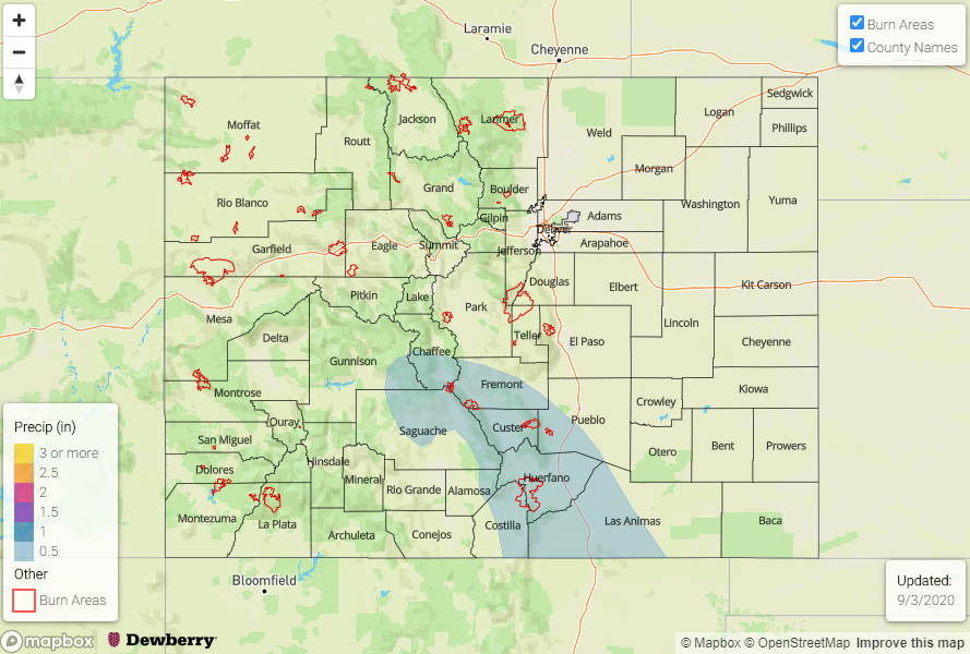
Overall, it will finally be cool statewide with mostly rain free conditions forecast for Tuesday. Rainfall chances tomorrow should stick to the southern mountains and favor the Southeast Mountains. At this time, mid-level energy doesn’t look widespread and unsure how much instability will be able to form by the afternoon. Therefore, storms should have some smaller storms cores and less instability to work with, which will limit their heavy rainfall potential. If a storm forms directly over a burn area (Spring Creek, Decker), there’s an increased risk for flash flooding with the slow storm movement. These burn areas will be closely monitored in tomorrow’s FTB, but chances for exceeding thresholds with the pop-like convection is on the lower end. So, No Apparent threat has been issued.

Event #2: Sunday – Monday (9/6 – 9/7)
No Apparent threat as a stronger shortwave moves southward on the east side of a ridging pattern.
Since there is such low confidence in model members this far out, still choosing not to draw a map. For the most part, the rainfall chances will be highest over the eastern plains where some moderate rainfall could develop. If the front can drop through at peak heating, there may be a chance for some more widespread thunderstorms. Unsure how far back west the low-level moisture will hang on, but scattered pops over the eastern mountains seem reasonable. Mostly just wanted to point out when the next cool down will occur as temperatures will be on the rise under the ridge, especially over western Colorado. At this time, there is No Apparent flood threat.