Issue Date: Saturday, August 29th, 2020
Issue Time: 11:00AM MDT
Summary:
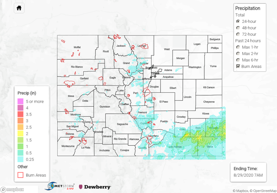
Beneficial rainfall covered much of Colorado yesterday, with most of it creating rainfall totals up to 0.5 inches. However, some locations were able to pick up some heavy rain totals, particularly in the Southeast Plains, where a convective system dropped up to 2.53 inches according to a USGS rain gauge in northeast Las Animas County. A CoCoRaHS gauge also reported 2.52 inches of rain just north in southeast Otero County, indicating this heavy rain was not an isolated event. In fact, today’s QPE map shows much of the northern Raton Ridge and southern Southeast Plains regions picked up over 0.5 inches. Fortunately, no flooding was reported with the heavy rain in this area, likely due to the prolonged period of rainfall and the dry soils. A Flash Flood Warning was issued by NWS Pueblo for the Spring Creek burn area last evening, but no reports of flooding have come in as of this morning. Rain gauges near the area indicate up to 0.3 inches of rain fell, with one gauge reporting up to 0.42 inches (CoCoRaHS). Rain totals up to 0.6 inches were reported by CoCoRaHS observers in Custer County, in the Southeast Mountains, with up to 0.44 inches reported in Boulder County along the Front Range.
Yesterday was also our first day of cooler air in quite awhile along the eastern plains as a cold front moved through. Denver only high a high temperature of 80F, 5 degrees below average. Some locations along the Urban Corridor didn’t even get out of the 70Fs. This is a welcome relief.
Ongoing large fire update (as of 11:00 AM on InciWeb):
Pine Gulch – north of Grand Junction: 139,006 acres; 77% contained (Colorado’s LARGEST WILDFIRE)
Grizzly Creek – Glenwood Canyon: 32,448 acres; 71% contained (little growth, increased containment)
Cameron Peak – Medicine Bow Mountains: 23,007 acres; 0% contained
Williams Fork – Arapaho National Forest: 12,079 acres; 5% contained
For rainfall estimates in your area over the last 24 hours, check out our State Precipitation Map below.
Click Here For Map Overview