Issue Date: Thursday, August 27th, 2020
Issue Time: 9:35AM MDT
Summary:
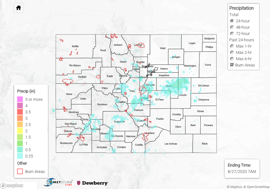
Moisture continued to accumulate under the ridge, and a couple days of rainfall helped moisten the boundary layer. Both of these factors lead to an increase in storms coverage, intensity, and rainfall totals on Wednesday, which was beneficial for the ongoing fires as storms produce only minimal lightning. The higher moisture allowed storms to fire over the mountains a little earlier than typical, first firing over the Front Range just after 11AM. By about 3PM, coverage of rainfall over the mountains and higher elevations of western Colorado was fairly widespread with the convection mostly confined to the peaks and ridges. Over western Colorado, the San Juan Mountains received the most wetting rainfall with a large area receiving at least 0.25 inches, and southern La Plata County reporting 0.25 inch hail. SNOTEL sites recorded about 0.60 inches of precipitation, and a CoCoRaHS site in western Rio Grande reported the same. Beneficial rainfall also fell over the San Luis Valley in the evening hours, and a CoCoRaHS station between Alamosa and Monte Vista reported 0.43 inches. The official report at the KALS airport was 0.08 inches. August precipitation climo is about 1 inch for the interior of the valley.
Back over the Front Range, a couple observations around 0.95 inches were recorded over the southern Front Range (ALERT, CoCoRaHS, MesoWest). Several outflow boundaries over the Palmer Ridge help trigger some much needed, widespread rainfall for the area yesterday evening. Reminder, Douglas County is having its driest year on record. QPE had widespread totals between 0.25 and 0.50 inches, and CoCoRaHS stations near Limon had between 0.63 and 0.68 inches. Over Denver, totals were generally less than 0.25 inches.
As far as flooding, a Flash Flood Warning was issued for the Pine Gulch Fire around 3:30PM, and 0.65 inches of rain fell over about an hour and a half (starting at 3PM). A flash flooding report indicated a shallow debris flow at the edge of the burn area with the exact location along Roan Creek Road unknown. Other than that, flooding was not reported yesterday.
Ongoing large fire update (as of 9:30AM on InciWeb):
Pine Gulch – north of Grand Junction: 135,958 acres; 53% contained
Grizzly Creek – Glenwood Canyon: 32,302 acres; 61% contained
Cameron Peak – Medicine Bow Mountains: 21,017 acres; 0% contained
Williams Fork – Arapho National Forecast: 11,992 acres; 5% contained
To see precipitation estimates over your area the last 24 to 48-hours, scroll down to the State Precipitation Map below.
Click Here For Map Overview