Issue Date: Wednesday, August 26th, 2020
Issue Time: 11:15AM MDT
Summary:
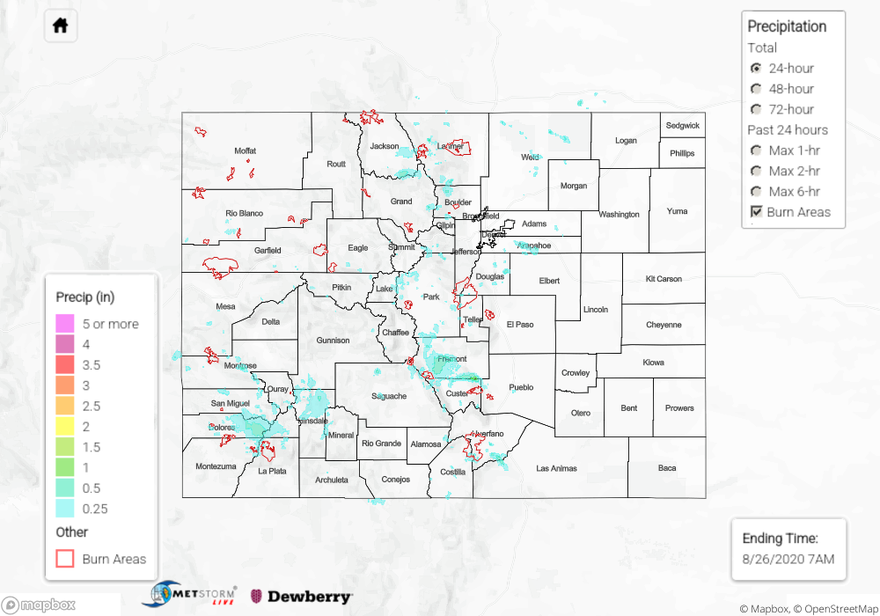
Showers and storms covered much of the high terrain across Colorado yesterday, producing rain totals up to 0.82 inches according to rain gauge observations. This 0.82 inch total was reported by a CoCoRaHS observer along the southern tip of the Spring Creek burn area, and 0.46 inches was reported on the other side of the mountain ridge along the southwest edge of the burn area. A nearby USGS gage reported 0.5 inches. Surprisingly, no flooding was reported near the Spring Creek burn area as of this morning.
Elsewhere, A 0.7 inch rain total was reported from a CoCoRaHS observer in Rico (western San Juan Mountains), and totals near up to 0.75 inches were observed in Douglas County, south of the Denver metro area. A SNOTEL site at Hayden Pass (northern Southeast Mountains) also reported 0.7 inches of rain accumulation. Today’s QPE map shows heavy rain fell over Fremont County, with totals just over 1 inch indicated near the southern border with Custer County. Storms over this area triggered the one and only flash flood warning yesterday. No flooding was observed across Colorado as of this morning.
Ongoing large CO fire update (as of 10:45AM on InciWeb):
Pine Gulch – north of Grand Junction: 135,920 acres; 47% contained
Grizzly Creek – Glenwood Canyon: 32,060 acres; 61% contained (large jump in containment)
Cameron Peak – Medicine Bow Mountains: 21,017 acres; 0% contained
Williams Fork – Arapaho National Forest: 11,726 acres; 5% contained
For rainfall estimates in your area over the last 24 to 72 hours, check out our State Precipitation Map below.
Click Here For Map Overview