Issue Date: Monday, August 24th, 2020
Issue Time: 2:30PM MDT
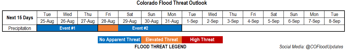
Valid Dates: 8/25– 9/8
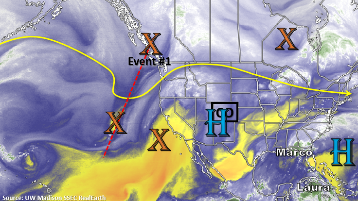
It has been hot the last few days, and the heat is expected to continue until a cold front drops through the state at the end of this week. There’s a positively tilted trough to our west (red dotted line) that will start to move inland today. This will help weaken the ridge and push the axis in a more favorable position to pull more subtropical moisture northward. With daily rounds of rain forecast the next couple of days due to increased mid and upper level moisture, expect the boundary layer to moisten, which will allow for higher totals to reach the ground each afternoon over the mountains.
Lee troughing over the plains is also forecast, but it looks like it will be pretty well capped unless there’s a strong, well-timed shortwave that moves through. Best chance for storms over this area will be at the end of the week. Late Thursday into Friday, a cold front drops south, which looks to return some higher surface moisture. With more westerly steering flow aloft, storms have the potential to survive over the plains as they move off the mountains. An Elevated flood threat has been issued. From Saturday into Monday, expect storm coverage to decrease each afternoon as a strong trough dips south and starts to push a dry air mass into the state.
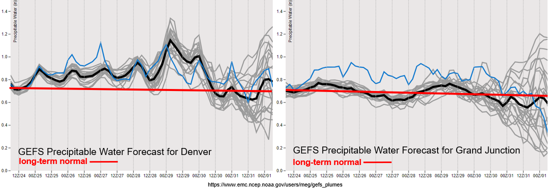
Looking at near and slightly above average PW from tomorrow into Friday morning. This will help produce daily rounds of rainfall over the mountains. Gusty outflow winds and local, dry lightning will still be a concern before more wetting rainfall occurs Wednesday over western Colorado. On Friday, there’s a big increase in PW over eastern Colorado associated with that cold front. Extra sub-tropical moisture should also be over the Great Plains, so some extra moisture could be drawn into the state Friday and Saturday with south/southeasterly surface flow. Another reason for the Elevated flood threat. Lots of disagreement between model members by next week, but if the PW values follow the low-end members, there could be an increase in fire weather conditions.
Event #1: Tuesday – Thursday (8/25 – 8/27)
No Apparent threat as mid and upper level moisture move over the state and return storms to the mountains each afternoon.
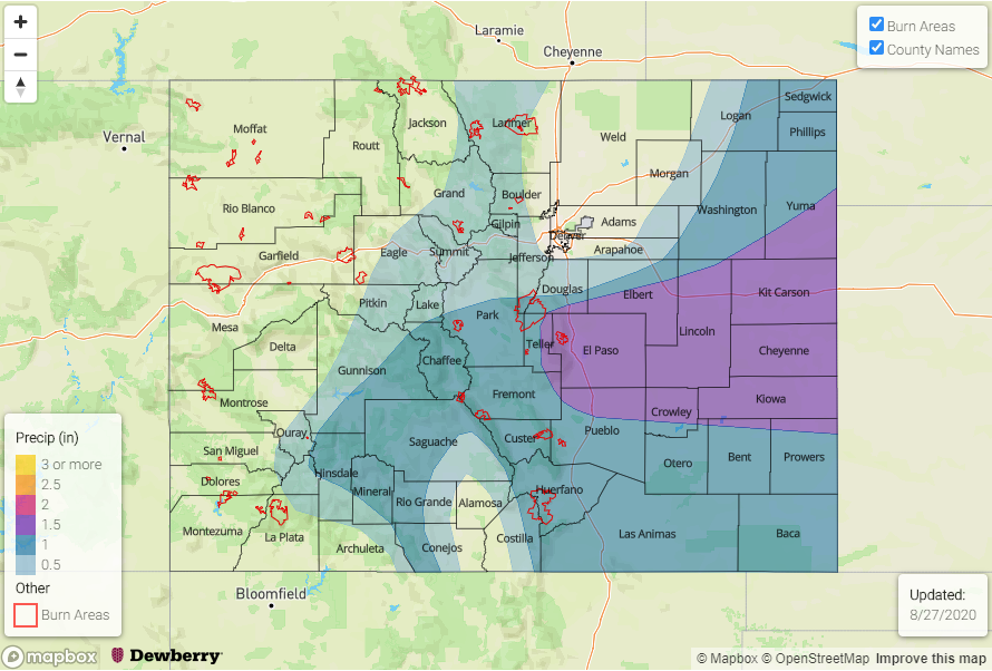
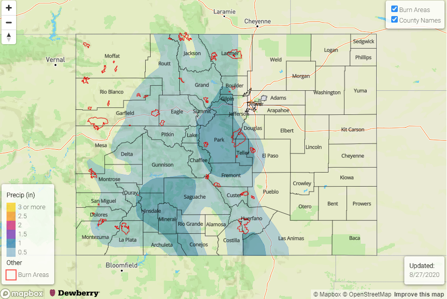
No Apparent threat for Event #1 as mid and upper level moisture increases across the state with some extra mid-level energy moving through the flow. Storms for the most part will be high-based, so not thinking there’s a large flood threat at this time. Increasing wetting rains are anticipated on Wednesday and Thursday, which will be good for the ongoing fires over the mountains. Going to add the new burn areas to the threat map tomorrow, so we can keep an eye on those. The Grizzly Creek fire will be monitored the most closely the rest of the season as Glenwood Canyon is already dangerous with its steep, rocky slopes.
Event #2: Friday – Monday (8/28 – 8/31)
Elevated/No Apparent threat as a front helps return some low-level moisture to eastern Colorado.
This shouldn’t be a prolonged Elevated event, but with increased moisture and slower steering winds under the ridge, storms may be able to produce some flooding on Friday. After a likely break in widespread rainfall over the mountains on Thursday, precipitation chances will increase over a larger area again. The Southeast Mountain burn areas will be monitored closely as well as some of the newer burn areas. Without much upper air support, the threat for severe weather is on the lower end over the plains, but be sure to check back on Thursday as details will likely change for this event.