Issue Date: Sunday, August 23rd, 2020
Issue Time: 10:15AM MDT
Summary:
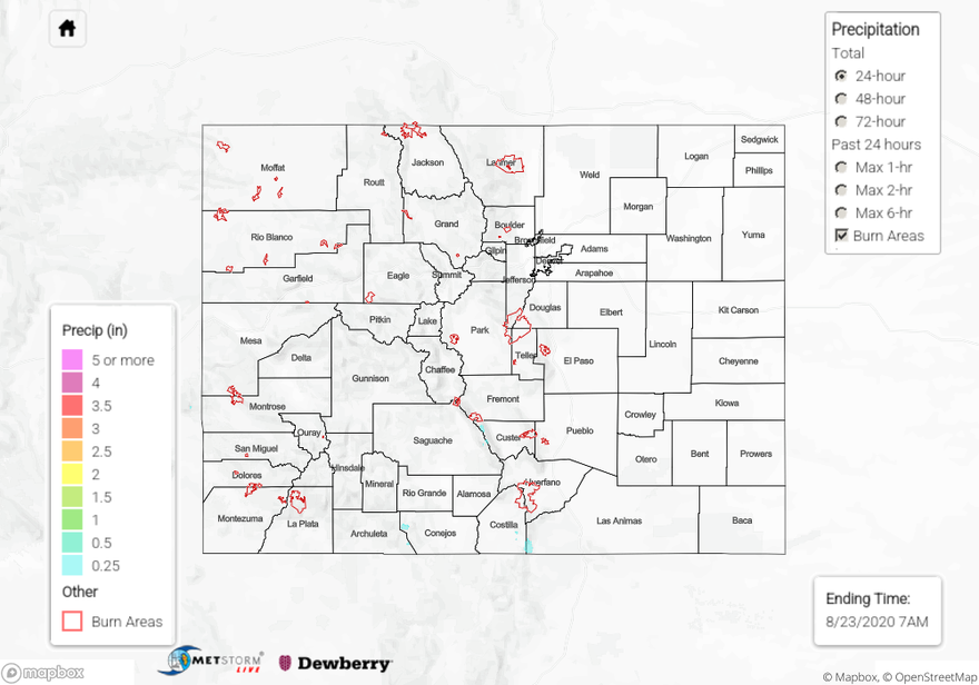
Storms stuck to the southern mountains yesterday, producing up to 0.31 inches of rainfall near Cortez (Southwest Slope) according to rain gauges. A similar total of 0.29 inches was recorded near the CO/NM border southeast of Durango. Radar indicates storms fired over the San Juan Mountains and moved south over these areas over an hour or two during the early afternoon. These rain totals match well with the expected rain rates for the area (0.3 in/hr) in yesterday’s Flood Threat Bulletin. Further east, along the western edge of the Southeast Mountains, rain totals up to 0.1 inches were reported by CoCoRaHS observers.
Storms were unable to break the cap over the eastern border yesterday, even though the low pressure system set up a convergence boundary over Kit Carson County. It is possible the thick smoke over eastern Colorado yesterday may have reinforced this cap with mid-level heating from absorption of sunlight by dark smoke particles, potentially suppressing storms over the eastern border.
Temperatures soared again across the state, as Denver reached 97F (1F shy of tying the record), Grand Junction reached 98F (beat old record by 1F), and Pueblo reached 103F (beat old record by 3F). These hot temperatures are surprising considering the amount of smoke that lingered over the state yesterday, but the drier air and drought conditions likely are exacerbating the heat.
Wildfires continued to burn across Colorado yesterday (see updated info below). These CO fires along with fires across the US West are generating large amounts of smoke, which is blanketing much of the US West and causing unhealthy air quality. Check out this interactive map from AirNow that shows smoke plumes and air quality across the US:
Wildfire Update:
Pine Gulch – north of Grand Junction: 129,715 acres; 19% contained (2nd largest CO wildfire, grew ~ 3,000 acres)
Grizzly Creek – Glenwood Canyon: 30,362 acres; 30% contained (increase in containment)
Cameron Peak – Medicine Bow Mountains: 18,287 acres; 0% contained (grew ~ 1,000 acres)
Williams Fork – Arapaho National Forest: 10,813 acres; 3% contained
For rainfall estimates in your area over the last 24, 48, and 72 hours, check out our State Precipitation Map below.
Click Here For Map Overview