Issue Date: Sunday, August 23rd, 2020
Issue Time: 09:25AM MDT
— Flooding is NOT expected today
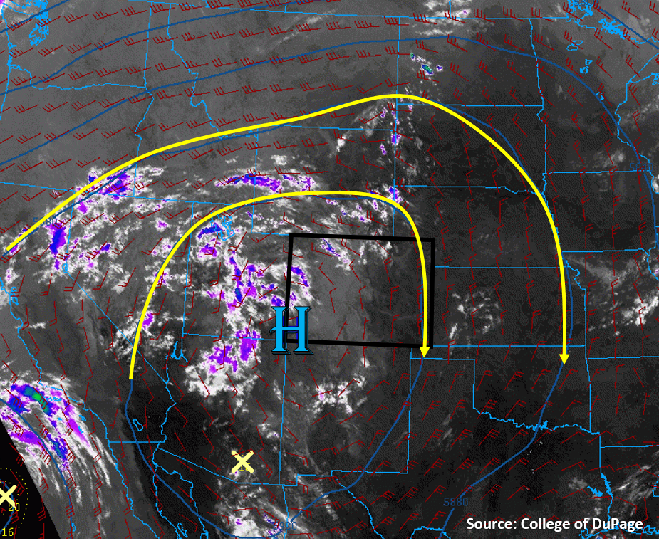
Not much has changed in today’s weather setup compared to yesterday, as Colorado is still located under the high pressure ridge dominating the western US (see image below). The only difference today is that there is a little more mid-level moisture trapped within the anticyclonic flow around the center of the high pressure, which is showing up as more clouds (white, purple, & blue colors) in the IR satellite image below. This mid-level moisture is mostly over Utah currently, but it will circulate into Colorado today. What this means for Colorado is that more high-based mountains showers and isolated weak storms will develop with diurnal heating today. Soundings from Grand Junction and Denver indicate less moisture exists in the low-levels, with PW values similar to yesterday (0.52” to 0.57”). The lack of low-level moisture will keep the chance for precipitation over the high terrain. No flooding is expected today.
Dry air at the surface will allow temperatures to soar once again to near record levels across the state. Additionally, smoke from the numerous wildfires across the US West and Colorado will continue to lower air quality across Colorado today. Mixing of the boundary layer air with diurnal heating today will help improve surface air quality, but conditions will degrade overnight again.
Today’s Flood Threat Map
For more information on today’s flood threat, see the map below. Hover over the threat areas for more details, and click on burn areas to learn more about them. For Zone-Specific forecasts, scroll below the threat map.

Zone-Specific Forecasts:
Grand Valley, Northwest Slope, Northern Mountains, Central Mountains, Front Range, Southwest Slope, San Juan Mountains, Southeast Mountains, & San Luis Valley:
Diurnal heating will cause afternoon clouds and showers to develop over the high terrains this afternoon. A few locations may be able to develop enough instability for a few thunderstorms to fire, but rain rates should stay below 0.3 in/hr with these storms. The highest chances for showers and storms is again over the southern San Juan Mountains, where slightly higher dew points are present this morning. Storms could also produce some gusty winds up to 40 mph, which could impact wildfire containment efforts, but otherwise winds should stay fairly weak. No flooding is expected today.
Smoke will continue to impact the area and lower air quality. Outdoor activities should be limited today. Additionally, temperatures will be quite hot, with locations in the Grand Valley approaching the 100F mark. Be sure to stay hydrated.
Primetime: 12PM to 8PM
Northeast Plains, Urban Corridor, Palmer Ridge, Raton Ridge, & Southeast Plains:
Mostly sunny and hot with an isolated weak thunderstorm not out of the question during the afternoon and evening. Clouds from high-based storms drifting off the mountains could reduce sunshine over the Urban Corridor, but little to no rain accumulation is expected. Highest chances for rain will be over the Palmer Ridge, where max 1-hour rainfall up to 0.3 inches is possible. Flooding is not expected today.
Smoke continues to lower air quality, especially across the Urban Corridor. An Air Quality Alert has been issued by NWS, so driving gas/diesel vehicles and exercising outdoors is not recommended today. Temperatures will also rise into the upper 90Fs along the Urban Corridor and Northeast Plains, and into the low 100Fs along the Southeast Plains, potentially adding to the streak of record temperatures.
Primetime: 1PM to 8PM