Issue Date: Saturday, August 22nd, 2020
Issue Time: 10:45AM MDT
Summary:
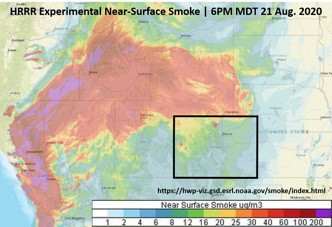
Other than a few clouds over some of the high terrains yesterday, Colorado’s clear skies were infiltrated with wildfire smoke. The image below shows the experimental near-surface smoke concentration from the HRRR weather model at 6PM last evening. The reds and purple colors indicate high concentrations of near-surface smoke. There is a large plume of smoke streaming from California wildfires across the US West and into northern Colorado. Increased smoke concentrations can also be seen coming from the Pine Gulch and Cameron Peak fires in Colorado. This abundance of smoke is decreasing air quality for much of Colorado and the US West, and will likely continue to do so for some time. A summary update on Colorado’s current wildfires is below.
Temperatures remained above average across Colorado yesterday, with Denver and Grand Junction reaching into the mid and upper 90Fs. With another week of temperatures in the 90Fs for Denver, this puts Denver in 2nd place for the most 90 degree days in a year. NWS Denver/Boulder has a nice graphic in their weather story today with more info on the summer heat (https://www.weather.gov/bou/weatherstory). With continued heat expected over the next week, we will inch closer to the all-time record set in 2012!
Wildfire Update:
Pine Gulch – north of Grand Junction: 126,613 acres; 19% contained (2nd largest CO wildfire; progress on containment)
Grizzly Creek – Glenwood Canyon: 29,992 acres; 22% contained (progress on containment)
Cameron Peak – Medicine Bow Mountains: 17,246 acres; 0% contained
Williams Fork – Arapaho National Forest: 10,437 acres; 3% contained
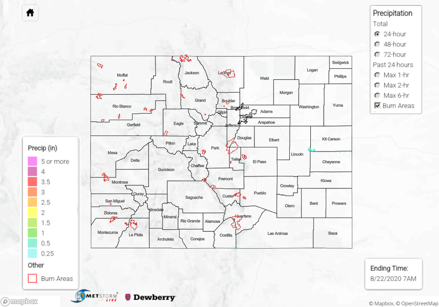
Check your local rainfall estimates from the last 24, 48, and 72 hours using our State Precipitation Map below.
Click Here For Map Overview