Issue Date: Tuesday, August 18th, 2020
Issue Time: 10:30AM MDT
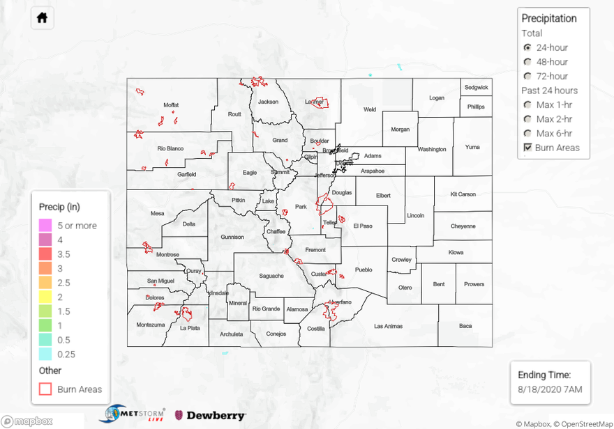
Summary:
Some showers from weak storms over the Central, Southeast, and San Juan Mountains produced generally light rain totals for higher elevation locations, but finally the western San Juan Mountains got some rainfall. An isolated area of high rain totals over the last 24 hours were recorded in La Plata County, where 1.12 and 0.76 inches of rain were reported by CoCoRaHS observers in Hermosa and Trimble, respectively. A USGS rain gauge just north near Electra Lake picked up 0.38 inches and another station just southwest of town picked up 0.41 inches. Composite radar images indicate two rounds of storms moved over this area between 2PM and 5PM. Due to the limited low-level radar observations in the area and the small, isolated storm core, today’s MetStorm Live QPE map does not pick up on this rainfall. No flooding reports were submitted from this rainfall as of this morning. The high rain totals were likely possible due to a pocket of increased dew points (low 40Fs) that banked itself against the southern edge of the San Juan Mountains, as visible from MesoWest observations and mesoscale analysis. This extra low-level moisture likely allowed increased instability and heavier rain rates. Farther east in Archuleta County, up to 0.22 inches of rain fell according to CoCoRaHS rain gauges. Lower accumulations were observed elsewhere.
Temperatures topped out at 98F in Denver yesterday, which beat the previous record of 97F from 2013. Grand Junction hit 97F, which was 3F from their daily record. Temperatures are likely a few degrees cooler than they normally would be with the thick smoke in the area. Near-record heat is expected to continue today with the very strong High pressure system.
Wildfire Update:
Pine Gulch – north of Grand Junction: 87,209 acres; 7% contained
Grizzly Creek – Glenwood Canyon: 25,007 acres; 0% contained (no change)
Cameron Peak – Medicine Bow Mountains: 12,323 acres; 0% contained
Williams Fork – Arapaho National Forest: 6,627 acres; 0% contained
For rainfall estimates in your area over the last 24, 48, and 72 hours, check out our State Precipitation Map below.
Click Here For Map Overview