Issue Date: Wednesday, August 5th, 2020
Issue Time: 10:55AM MDT
Summary:
Some rainfall was observed along portions of the eastern plains, but rain gauge observations indicate totals were only up to 0.3 inches over the last 24 hours. The northeastern corner of the state saw one round of storms straddling the Colorado/Nebraska border between 4:30PM and 8:30PM MDT, which are visible on the satellite image from last evening (see below). However, the majority of rainfall fell overnight between 9:30PM and 12:30AM MDT as a cluster of storms moved through Logan, Sedgwick, and Phillips counties. The highest rain accumulation from these storms was 0.23 inches from a CoCoRaHS observer in northwest Phillips County. QPE indicates the heaviest rain from these storms fell over northern Sedgwick County, with bias-corrected MetStorm Live QPE indicating up to 0.5 inches and MRMS QPE suggesting just over 1 inch may have fallen. No rain gauges were available in the heaviest rain core to verify these QPE totals.
A second batch of nocturnal convection dropped some rain just north and east of the Palmer Ridge, with the heavier showers moving through between 2:30AM and 5:30AM MDT. Today’s QPE map shows totals just over 0.5 inches of rain fell over southern Washington County from these convective showers, but the closest rain gauge observations are 0.10 inch along the western and 0.08 inch along the eastern edges of this storm track. A band of convective showers further south produced up to 0.29 inches of rain in Cheyenne County. No flooding was reported with these nocturnal storms.
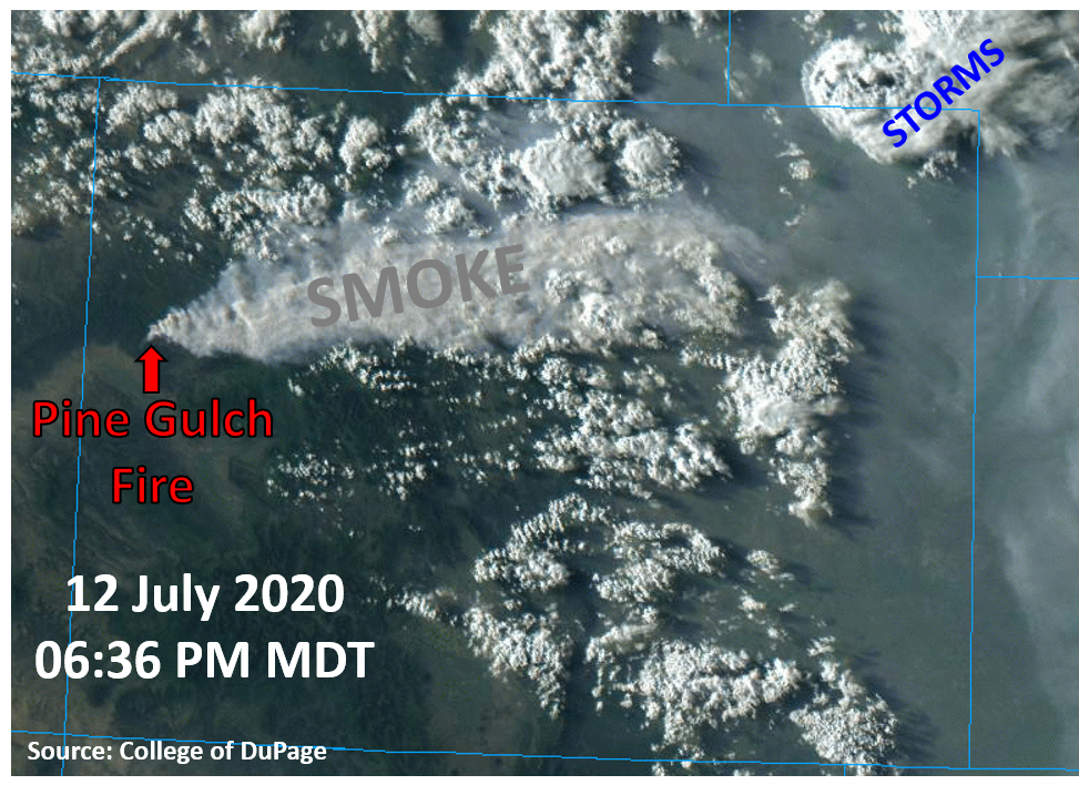
The Pine Gulch and Grizzly Creek wildfires continued produce copious amounts of smoke over the central and northern mountains yesterday, which was easily visible on the satellite imagery last evening (see image below). The Pine Gulch wildfire has reached an impressive 68,323 acres as of this morning, and the Grizzly Creek wildfire has grown to 4,624 acres as of late last night. The smoke from these fires is causing air quality issues for much of the Grand Valley, Central & Northern Mountains, and along the Front Range & Urban Corridor. Unfortunately with continued dry weather expected today, we will likely be dealing with smoke again today.
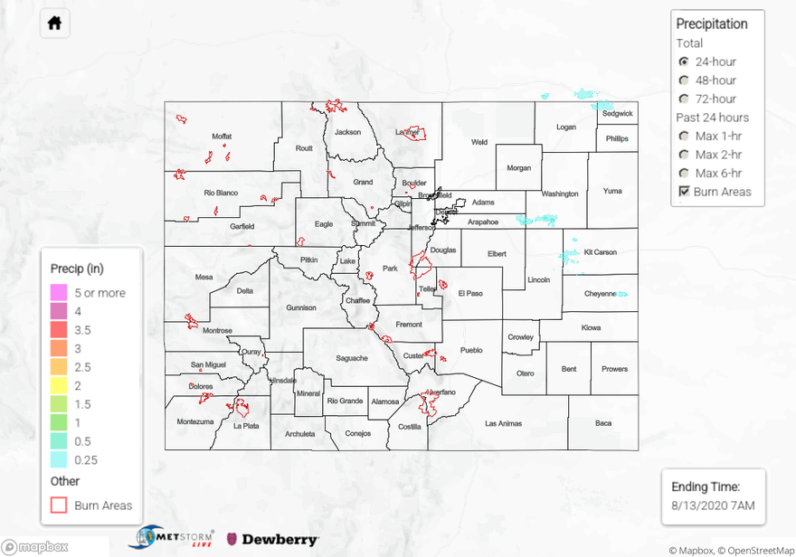
For rainfall estimates in your area over the last 72 hours, check out our State Precipitation Map below.
Click Here For Map Overview