Issue Date: Monday, August 10th, 2020
Issue Time: 2:50PM MDT
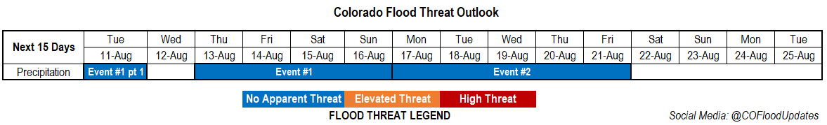
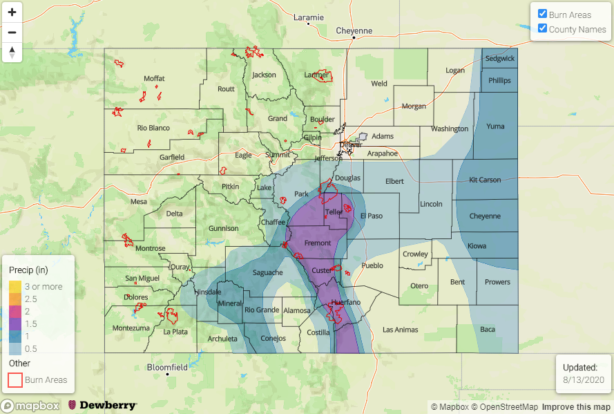
Valid Dates: 8/11– 8/25
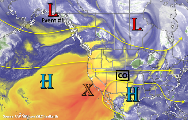
The water vapor imagery below is showing a massive area of dry air over the majority of the western US (yellow and orange). There’s a bit of blue over northern Colorado, which is associated with the weak cold front that moved through the area this morning. This moisture will help return some scattered storms to eastern Colorado today, but a cap and mixing out of surface moisture will keep the storms scattered and high-based with the main threat being brief, outflow winds. Tomorrow, a dry line sets up over the eastern plains with lee troughing, so this will be the main focus for storm coverage as dry air continues to be entrained with the west and southwest flow over the rest of Colorado. The thunderstorms that develop over the border counties should be moving fast enough and have small enough rainfall cores that there is No Apparent threat for flooding at this time.
Brief break in rainfall on Wednesday as the dry air continues to suppress afternoon convection chances and push higher surface moisture into Kansas and Nebraska. By Thursday, the Low marked below moves north of Colorado and some extra mid-level energy will mix with more moisture to return afternoon storms chances. As the High rebuilds and strengthens over the Desert Southwest (Event #1 and #2), scattered storms are expected each afternoon with residual moisture trapped under the ridge. Rainfall looks to favor the southern high terrains with occasional storm activity over the adjacent and eastern plains.
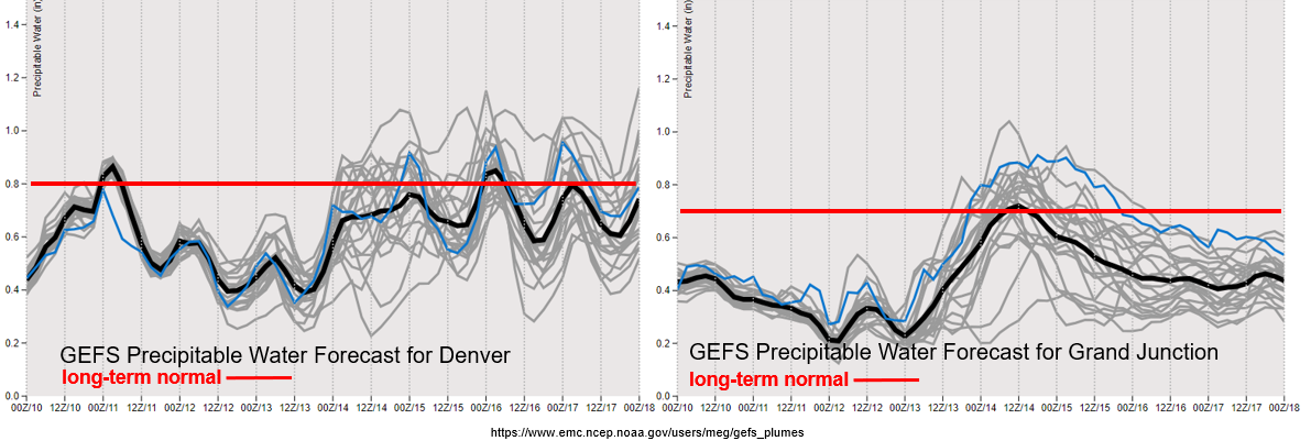
It remains very dry over western Colorado through the end of this week with some possible daily low PW records being broken. PW values also drop off over eastern Colorado after today. This will limit precipitation chances across the state until that Low begins to advance inland. As the Low begins to advance inland, expecting the surface gradient to tighten as a response. With increased surface winds forecast beginning on Wednesday, elevated and critical fire weather conditions are likely over western Colorado and perhaps some mountain valleys. There is a chance for weak storms to return to portions of the San Juan and Central Mountains by Thursday/Friday, but outflow winds from the storms might cause issues with ongoing fires as widespread wetting rainfall is not forecast. Best chance for wetting rains will be over the south high terrains and along/near the Continental Divide, and by Sunday some activity may spill into the adjacent plains.
Event #1: Tuesday – Sunday (8/11 – 8/16)
No Apparent threat as storms stick mostly to the mountains with a peak in activity on Sunday behind a weak cold front.
Some weak thunderstorms will be possible over the border counties tomorrow with max 1-hour rain rates up to 1.3 inches and severe hail possible. Upper level dynamics will be lacking, so the severity threat is on the lower end; however, storms could also produce some damaging outflow winds. With faster storm movement to the east and southeast, and small storm cores, flooding is not expected. By Thursday, the chances for rainfall increase over the mountains as some mid-level energy and moisture move into the area. Scattered storms and high-bases should keep the flood threat away, but expect a chance of precipitation each afternoon over the southern high terrains. Increased fire weather is also likely by mid-week with the tightening gradient. By Sunday, another weak cold front begins to move south. Depending on the depth of the low-level moisture and arrival time of the front, some more heavy rainfall will be possible over the eastern plains. At this time, there is No Apparent flood threat.
Event #2: Monday – Friday (8/17 – 8/21)
No Apparent flood threat as a strengthening High suppresses high PW to the south and east.
With a strengthening High over the Four Corners, rainfall chances will be on the lower end with some hot temperatures arriving back to Colorado. Residual moisture trapped under the ridge should be enough for some scattered afternoon storms on some afternoons over the mountains, but details this far out will change day to day. There is an equal chance that dry air will win out with only afternoon clouds and minimal rainfall. Occasional fronts and mid-level disturbances may increase the chances for some more moderate rainfall over the eastern plains with the northwesterly flow aloft for this period. At this time, there is No Apparent flood threat for Event #2.