Issue Date: Monday, August 10th, 2020
Issue Time: 10:10AM MDT
— Flooding is NOT expected today
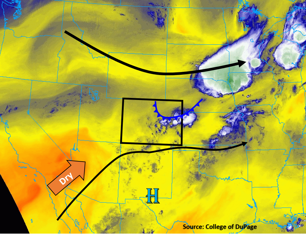
Mid-level and upper-level flow continues to be weak today, as Colorado is situated between a broad trough to the north and an elongated, weak high pressure region to the south (see image below). This will allow slow storm movements today. Additionally, a summertime cold front has banked its way up against the Front Range this morning, which has increased surface dew points back into the low 50Fs along the Urban Corridor and Northeast Plains. However, the Denver sounding this morning shows this surface moisture is very shallow, which has only increased the PW value to 0.53 inches (still below average). Some clouds and showers have developed over the Palmer Ridge and east to the Kansas border this morning (blue & white on the water vapor satellite image below), which lines up with the location of the cold front and some upper-level lift. This cold front will likely not make it much further south today. Cooler daytime high temperatures are expected behind the cold front for the northern plains. A surface low pressure is sitting over southeastern Colorado, which is helping more moist easterly flow impinge on the eastern side of the Palmer Ridge. This low pressure area will sit over southeastern Colorado today and reinforce the weak surface moisture up against the Front Range mountains and Palmer Ridge along with the northeasterly upslope flow behind the cold front. With diurnal heating, some of the shallow surface moisture will mix out, but enough moisture should stick around to increase chances for rainfall over eastern Colorado. Storms are expected to fire over the Front Range this afternoon and make their way east, but limited moisture (40Fs and 50Fs dew points) and instability will keep rain rates low. The main threat will be gusty outflow winds. Flooding is not expected today.
Continued dry air over the desert southwest will be trying to push its way into southwestern Colorado, but the driest air should stay southwest of the state, which will allow some afternoon clouds and showers to once again develop over the high terrain. However, no flooding is expected.
Today’s Flood Threat Map
For more information on today’s flood threat, see the map below. Hover over the threat areas for more details, and click on burn areas to learn more about them. For Zone-Specific forecasts, scroll below the threat map.

Zone-Specific Forecasts:
Northeast Plains, Urban Corridor, Front Range, Palmer Ridge, Raton Ridge, Southeast Mountains, & Southeast Plains:
The biggest change today is the 10F cooler high temperatures for the Urban Corridor and Northeast Plains behind the cold front. However, this cold front will allow some isolated storms to fire over the Front Range and Palmer Ridge this afternoon, with the highest chances for storms over the Palmer Ridge. With limited surface moisture, these storms should stay fairly weak with max rain rates up to 0.8 in/hr over the Palmer Ridge. Gusty outflow winds up to 50 mph are also possible with storms this afternoon and evening. Lower rain rates, up to 0.4 in/hr, are forecast over the Front Range and Urban Corridor. These storms will slowly make their way east into the plains, where higher moisture closer to the eastern border of Colorado could increase max rain rates up to 1 in/hr. It is possible some additional storms may fire near or after sunset as the nocturnal low-level jet pushes moisture back west overnight. Due to the placement of the surface low pressure over the Southeast Plains, lower chances for storms exist over the Southeast Mountains and Raton Ridge due to dry westerly surface winds.
Primetime: 12PM to 2AM
Grand Valley, Northwest Slope, Northern Mountains, Central Mountains, Southwest Slope, San Juan Mountains, & San Luis Valley:
Mostly sunny and warm today, with high temperatures a few degrees above average. Clouds and showers could form over the high terrains, similar to the last few days. Flooding is not expected, as only isolated sprinkles are forecast.
Primetime: 12PM to 7PM