Issue Date: Wednesday, July 15th, 2015
Issue Time: 9:00 AM MDT
Summary:
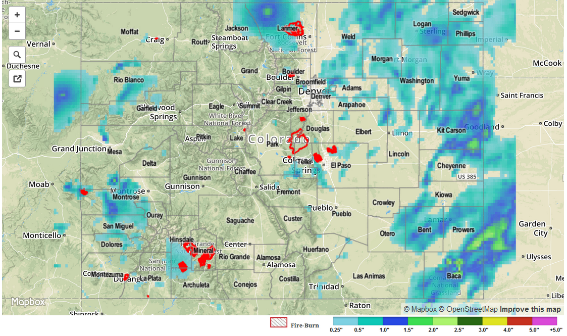
An uptick in coverage of showers and thunderstorms occurred yesterday as subtropical moisture continued to flow in from the southwest. Precipitable water values climbed to near, or above, an inch statewide, providing plenty of fuel for storms to produce heavy rainfall. There were a few flood advisories issued across the high country due to slow-moving storms, but no flash flooding reports have come in from those areas as of this morning. However, flash flooding accompanied a strong-to-severe thunderstorm over Prowers County, 1 mile North of Lamar. Other reports from near Lamar show thunderstorm wind damage (downed power pole 4 miles W of Lamar) and a thunderstorm wind gust of 77 mph (4 miles W of Lamar).
Slow-moving storms and efficient rainfall production due to deep moisture brought about moderate-to-heavy rainfall for numerous locations. According to CoCoRaHS observers, these counties were the big winners of rainfall totals:
Prowers: 1.05 inches, 0.96 inches
La Plata: 0.98 inches
Washington: 0.53 inches
Denver and Adams: 0.47 inches
Be sure and check the 24-hour, radar-derived, Storm Total Precipitation map below for an overview on statewide rainfall.