Issue Date: 7/14/2015
Issue Time: 10:17 AM
A MODERATE FLOOD THREAT HAS BEEN ISSUED FOR PORTIONS OF THE PALMER RIDGE, NORTHEAST PLAINS, AND SOUTHEAST PLAINS.
A LOW FLOOD THREAT HAS BEEN ISSUED FOR PORTIONS OF THE NORTHERN MOUNTAINS, NORTHWEST SLOPE, GRAND VALLEY, CENTRAL MOUNTAINS, SAN JUAN MOUNTAINS, SOUTHEAST MOUNTAINS, RATON RIDGE, FRONT RANGE, URBAN CORRIDOR, PALMER RIDGE, NORTHEAST PLAINS, AND SOUTHEAST PLAINS.
Subtropical moisture will continue to stream into Colorado along the western periphery of the upper-level ridge centered over the south-central US. The ridge has slid a bit further east today, which will allow fairly deep moisture to overspread the state. This, combined with a few weak disturbances embedded in the flow aloft, will allow for more coverage of thunderstorms today, each holding the potential to produce bouts with heavy rain. Weak mid-level flow will result in slower storm motions and increases the potential for excessive rainfall in any one location. Thus, the widespread low flood threat area as any stronger storm, no matter the location, will have the potential to produce heavy rainfall. Urban areas, burn scars, and locations with unstable soil (i.e., Chafee County), will be of primary concern today.
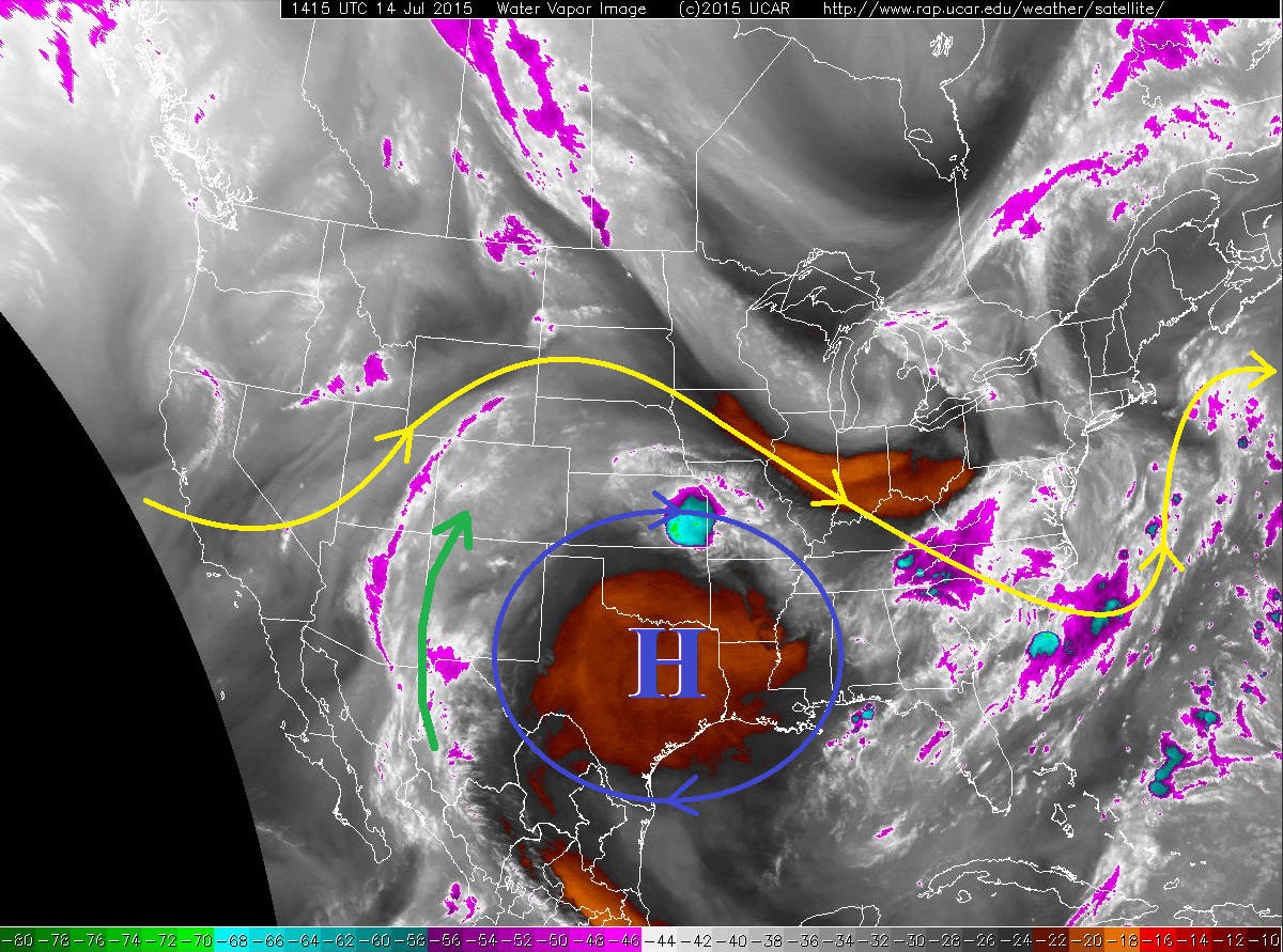
Additional primary concerns exist across the eastern third of Colorado, where scattered strong-to-severe storms are expected to develop this afternoon and evening. The main threats from these storms will be strong winds and large hail, as well as heavy rain. Rain rates will be sufficiently high to cause urban and rural flooding/ponding, and small streams that react quickly will need to be monitored should heavy rain move over their basins. Later in the evening, storms from the west will congeal into one or two thunderstorm clusters, producing heavy rain and strong winds as they move eastward over portions of the Palmer Ridge, Northeast Plains, and Southeast Plains, reaching Kansas during the early overnight hours.
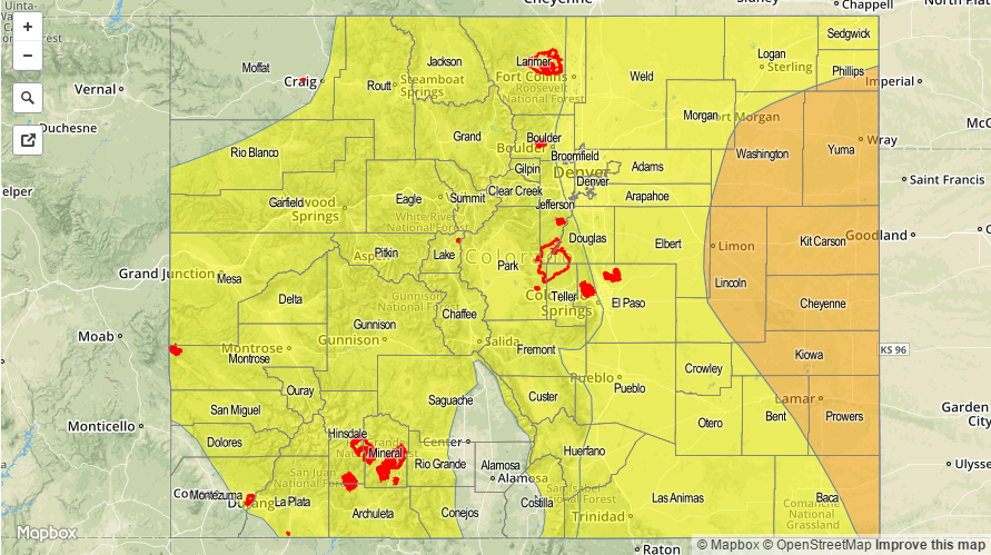
Today’s Flood Threat Map
For more information on today’s flood threat, see the map below (hover over threat areas for more details). For Zone-Specific forecasts, jump below the map.

Zone-Specific Forecasts
Urban Corridor, Raton Ridge, Palmer Ridge, Southeast Plains, and Northeast Plains:
Scattered thunderstorms are expected today and tonight, with stronger storms capable of producing heavy rainfall. Maximum rain rates vary across the regions, so let’s break it down…
Urban Corridor and Raton Ridge: 0.8-1.4 inches/hour
Palmer Ridge, Northeast Plains, and Southeast Plains: 2.0-3.0 inches/hour
Timing: 11 AM – Midnight
Front Range, Central Mountains, Southeast Mountains, Northern Mountains, Northwest Slope, San Luis Valley, San Juan Mountains, Southwest Slope, and Grand Valley:
Scattered showers and thunderstorms expected to begin by 11 AM, continuing through the afternoon and evening, with a few lingering overnight and into tomorrow morning. With the amount of moisture available across all regions, heavy rainfall will be possible from a stronger storm in any of the regions. Thus, the widespread low flood threat area. Maximum rain rates will be 0.8-1.2 inches/hour. Thunderstorms will favor the higher terrain, as orographic effects will play a role in storm development and storm motions will not move them quickly over lower elevations. Unstable soils and burn scars will be of primary concern for flash flooding/mud flow/debris slide issues.
Timing: 11 AM – 10 PM will be primetime, but a few thunderstorms (and heavy rain threat) will linger into tomorrow morning.