Issue Date: Thursday, July 30th, 2020
Issue Time: 4:45PM MDT
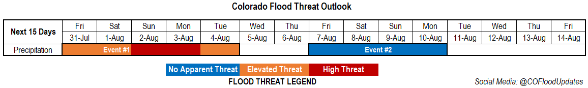
Valid Dates: 7/30– 8/14
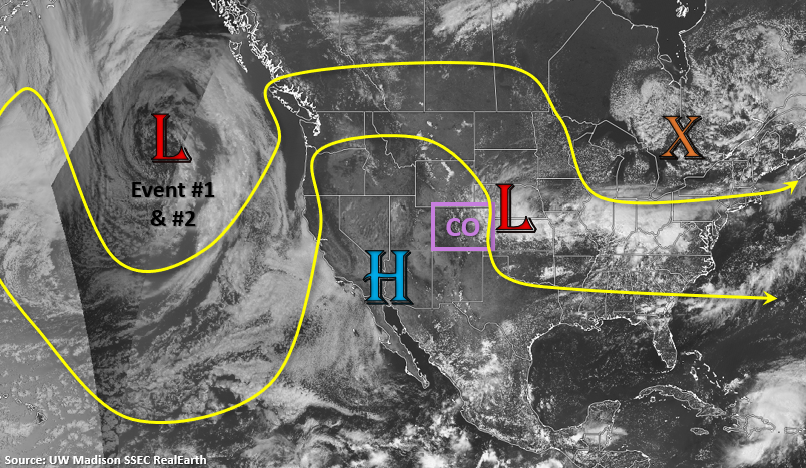
The ridging pattern for this next event will keep western Colorado dry, but several disturbances are expected to move through the flow over eastern CO, which will return daily rounds of storms to the eastern mountains and adjacent plains. As always, the timing of these shortwaves is imperative to the rainfall threat, and are hard to track more than a day out. However, this is an anomalously strong Low system, so thinking there will be plenty of mid-level energy in this dirty ridge pattern for more widespread storms over the eastern mountains. Additionally, with the on and off moisture, storms could pose a threat to recent burn areas over the Southeast Mountains through the start of next week. The Low will push to northern Rockies/plains by early next week, which will help raise the flood threat for either Sunday and/or Monday over the eastern mountains and adjacent plains.
While daily rounds of showers will be possible each day next week, they should be more isolated by mid-week before a more traditional monsoon pattern starts to set up next weekend (Event #2). Moisture looks to return statewide with another cut off low/west coast trough helping syphon moisture into the state with the High located somewhere over the High Plains.
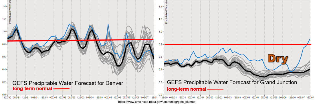
One word to describe the air mass over western Colorado through the end of next week: DRY. PW has quickly dropped off with the High over the Desert Southwest, which is pushing very dry air into the state with northwesterly flow. Thus, the chances of rainfall over the next week will be low. Not looking at any upper level jet features either, so at this time critical fire conditions are not anticipated.
Flipping back to the east – Colorado’s air masses often get nicely divided by the Continental Divide. Expect a break in heavy rainfall chances on Friday as dry air and subsidence fills in behind the departing upper trough. The Elevated flood threat has been issued for the Spring Creek burn area as storms activity in the area should be on the uptick when compared to today. Moisture is also on the rise and is quite elevated Sunday into Monday as the trough passes to our north. So, it is likely there will be a Moderate FTB threat issued on one or possibly both of those days, so a HIGH FTO threat is being issued. By Wednesday, expecting more isolated storm coverage over the mountains, but spread in the model members (gray lines) may cause these days to added back into the threat legend in Monday’s FTO.
Event #1: Friday – Tuesday (7/31 – 8/4)
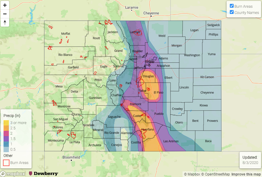
High/Elevated Threat as a strong Low will send disturbances through eastern Colorado, returning the flood threat to the eastern mountains and adjacent plains. This will elevate the threat for the recent burn areas over the Southeast Mountains.
On and off moisture, paired with disturbances, will keep storms in the forecast for the eastern mountains and adjacent plains beginning tomorrow. On high moisture days, the burn areas will need to be monitored more closely in the FTB. Storms should stick close to the mountains with more NNW steering flows; however, some activity could spill into the adjacent plains, especially as the trough moves from west to east late this weekend. The High threat is likely for either Sunday or Monday in association with the trough moving east. Still some timing changes between the models over the last couple of days, so that’s why the High is issued for both days. Even though this event is not of subtropical origins, the atmosphere will still be saturated enough for storms to drop local, heavy rainfall. The Elevated threat has also been issued for the duration of the event, due to increased mountain activities over the the weekend.
Event #2: Friday – Monday (8/7 – 8/10)
No Apparent Threat as the next monsoon moisture surge sets up.
Don’t put too much trust in the map below. By the end of next week, it looks like a more typical monsoon pattern, similar to the one last week, will set up. That is a High setting up somewhere over the Great Plains, and a trough over the west coast. At this time, the moisture content and PW plume does not look as strong as the last event with higher PW southwest and east of the state. We will continue to watch the details of this event evolve, and a more realistic picture of the event will be possible on Monday.