Issue Date: Thursday, July 30th, 2020
Issue Time: 10:35AM MDT
Summary:
Isolated showers and weak storms fired over the higher terrain yesterday, and storms generated gusty winds with the lack of low-level moisture. A 62 mph wind gust was reported near Grand Junction as a small storm tracked through the area, which dropped some large tree limbs on the road. Several locations across the Central Mountains and Grand Valley recorded these 60 mph wind gusts. Rain accumulations across the mountains stayed under 0.1 inch, except for Frisco, CO, where numerous showers tracked over the area during the afternoon. A CoCoRaHS observer recorded 0.14 inches of rain over the course of the day.
A couple stronger storms fired over the plains of eastern Colorado where some additional moisture was available along a convergence boundary in the area under a severe thunderstorm watch. A storm that tracked off the Front Range produced a 74 mph wind gust in Washington County just before 7PM. A train of storms created a swath of rainfall from Fort Collins east through Yuma County, which dropped up to 0.47 inches of rain between Fort Collins and Greeley according to rain gauges. QPE indicates higher rain totals over Weld/Morgan County, but no rain gauges are in this remote area to verify this small storm core estimation. A second cluster of storms fired over the Southeast Plains around sunset as this convergence boundary moved south, which produced up to 0.40 inches of rain near the CO/KS border in Prowers County according to rain gauge reports. QPE suggests similar rain totals fell northwest into Kiowa and Cheyenne counties from these storms. No flooding was reported in Colorado yesterday.
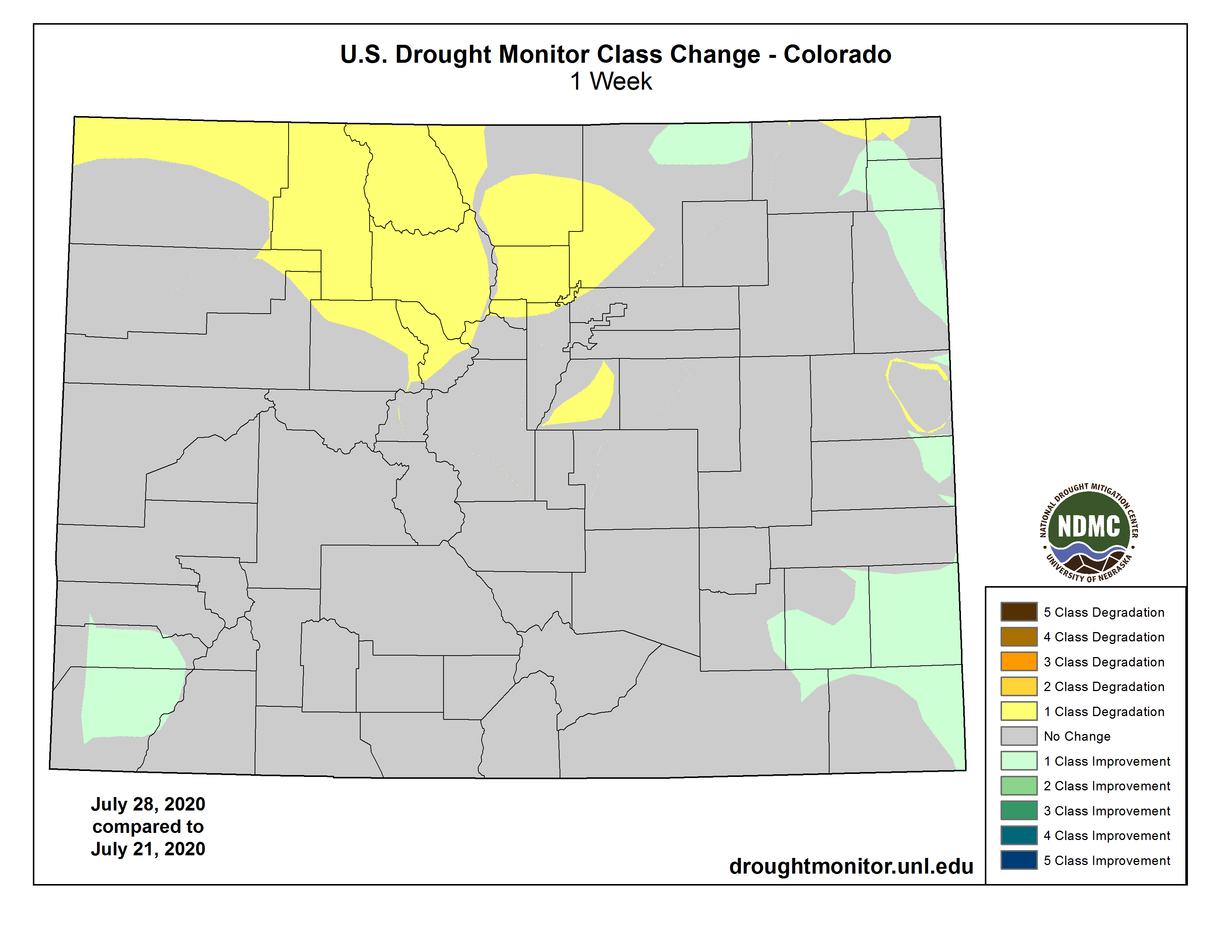
Today’s drought update shows that the rainfall over eastern and southwestern Colorado over the last week has improved drought conditions slightly. However, worsening drought conditions continued over northern Colorado, which did not see as much widespread rain. Check out the drought monitor change map below.
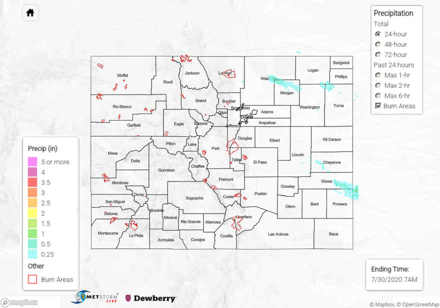
For rainfall estimates in your area over the last 24 hours, check out our State Precipitation Map below.
Click Here For Map Overview