Issue Date: Saturday, July 25th, 2020
Issue Time: 10:45AM MDT
Summary:
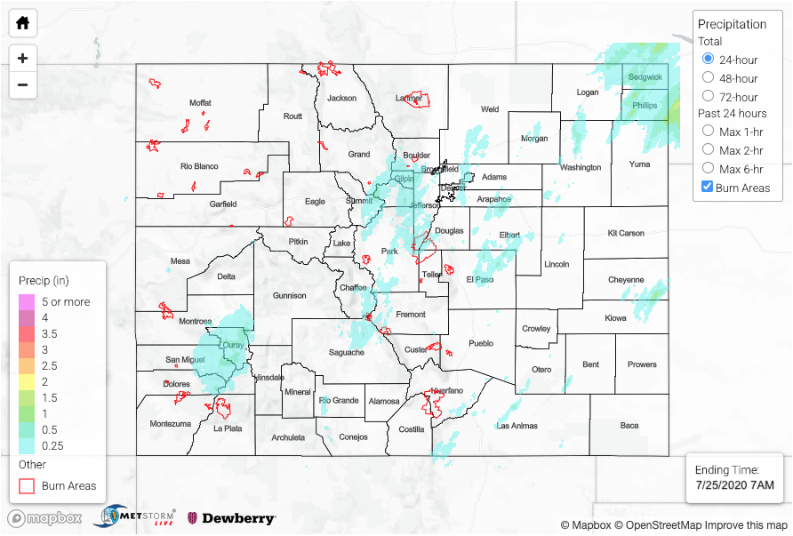
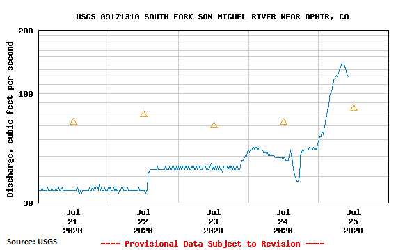
With the moisture plume in place, there was another round of rainfall oriented from southwest to northeast again. A little better moisture was in place, but over the mountains, limited instability allowed rain rates to stay low enough that there was little flooding reported. The highest totals over the Front Range were just under 0.75 inches. We’ve been keeping our eye on the the San Juan Mountains, as a multi-day rainfall event begins. The western portions picked up widespread totals of 0.75 inches to more isolate 1.50 inches on south facing slopes. An areal flood advisory was issued just before 6PM for the Uncompahgre Wilderness Area due to rock slides being reported onto roadways. Observations in the area ranged from about 0.80 inches to up to 2 inches! With more rain coming today and tonight, there’s an increased risk for mud flows and rapid rises in local streams/creeks. Streams in the area were already showing high flows (see the South Fork San Miguel River near Ophir below), which means some soils could already be saturated before today’s rainfall even begins (runoff). Please continue to follow the FTB for the latest and send any storm reports to us here: https://archive-coftb.dewberryanalytics.com/?page_id=11165
Training storms again produced high totals over the Northeast Plains, thankfully not directly over Wray AND slightly lower totals for Colorado. The heaviest rainfall from the storms was just over the border in Nebraska where about 4.5 inches of rain fell in the core (not shown below). A CoCoRaHS station in Phillips County observed 1.01 inches. Flooding was not reported on Friday.
To see precipitation estimates over your area the last 24 to 72-hours, scroll down to the State Precipitation Map below.
Click Here For Map Overview